KILIMANJARO
Climb Stats
7 Summit Number: One
Location: Tanzania
Altitude: 5,895m / 19,340ft
Date Summited: September 26th, 1999
Guiding Company: Gane & Marshall
Climbing Partners: Butterwick Hospice Care

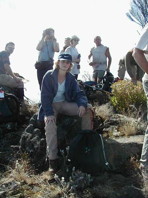
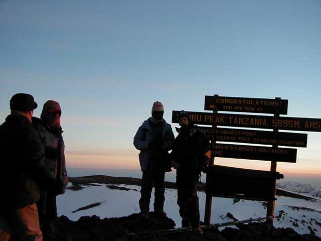
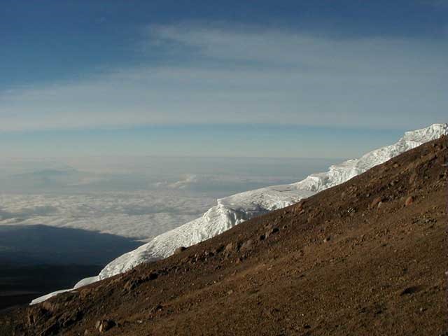
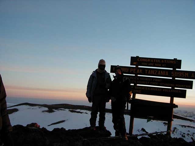
Uhuru Peak, the summit of Africa
Info
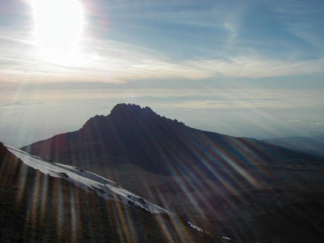
Kilimanjaro, located in Tanzania, is the highest mountain in Africa and the highest free-standing mountain in the world at 5,895m or 19,340ft above sea level. It is a dormant volcanic mountain composed of three distinct volcanic cones: Kibo, the highest at 5,895m (19,340ft); Mawenzi at 5,149m (16,893ft); and Shira, the lowest at 3,962m (13,000ft). Uhuru Peak is the highest summit on Kibo’s crater rim.
Background
An ex-girlfriend of mine and I decided to do this particular charity event after going to London to an Independent Travellers World exhibition, where there were various charities displaying their own sponsored treks, cycle rides, etc… This seemed like an excellent idea – we get to do a challenging adventure event and raise money for a worthy cause at the same time. After buying a copy of Wanderlust magazine and working our way through a double page spread of different charities and their own events we came across the Butterwick Children’s Hospice, who were organizing the Kilimanjaro wilderness trek. This was the one to do, and so we got about raising the necessary funds and getting fit.
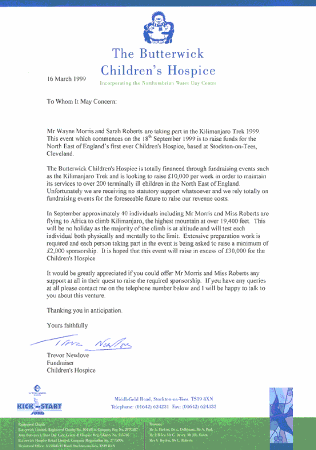
Copy of the letter that we sent out to approximately 300 local businesses asking for their assistance
Equipment Info
We were given an equipment list from Gane and Marshall with advice on minimum requirements, and various items that were necessary and recommended. A problem that we encountered was that we had never done anything like this before so we had no outdoor gear whatsoever, hence this was a totally new experience and a lot of advice was taken. Our kit list was as follows although there were certain items that we wish we had taken but didn’t.
Rab Ladakh 800 4 season down sleeping bag (-15°C rating)
North Cape silk liner
Thermarest ultralight sleeping mat
Petzl zoom head torch
Macpac Glissade 75 liter backpack
Lowe Alpine Walkabout 35 liter daypack
Pair Kohla trekking poles
Platypus 2 liter hoser
Trezeta boots
Mountain Equipment Changabang 3 layer Goretex jacket
Mountain Equipment Makalu 3 layer Goretex pants
Mountain Equipment down jacket
North Cape Polartec fleece
Paramo fleece
North Cape cap
North Cape mountain gloves
North Cape Coolmax baselayer pants
North Cape Coolmax top
North Cape & Bridgedale socks
Craghopper trekking pants
PUR Voyageur water purifier
Maglite torch
Mountain first aid kit
Multipurpose toolset
Mountain Equipment Snowline 4 season down sleeping bag (-20°C rating)
North Cape silk liner
Thermarest ultralight sleeping mat
Petzl zoom head torch
Macpac Cirrus 65 liter backpack
Vaude Bike and Day 25 liter daypack
Pair Kohla trekking poles
Platypus 2 liter hoser
Meindl Borneo boots
Mountain Equipment Denali 2 layer Goretex jacket
Mountain Equipment Makalu 3 layer Goretex pants
Mountain Equipment synthetic jacket
North Cape Polartec fleece
Paramo shirt
North Cape cap
North Cape mountain gloves
North Cape Coolmax baselayer pants
North Cape Coolmax top
North Cape & Bridgedale socks
Rohan bags trekking pants
These were the various pieces of gear that we realized would have been useful but didn’t take.
Inner mittens
Factor 35 suntan cream
Spare Petzl head torch batteries
Metal flask
More Paracetamol
– Taking photographs without having to use bulky mountain gloves
– Instead of the factor 4 we took!!
– Used more than we thought
– For summit night as the platypus’s froze up
– For the monotonous headaches
Itinerary
Saturday 18th September
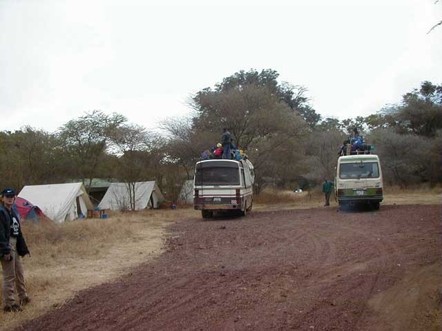
We arrived at Ndarakwai tented camp at midnight after a long flight from the UK. It was to be dinner, which turned out to be very enjoyable, and then straight off to bed.
The camp was right out in the bush and all kind of noises could be heard throughout the night, but it really was the great outdoors right out in the middle of nowhere. Nearby there were all kinds of animals, including elephants, baboons, and herds of eland.
19th September
Lemosho Route Rainforest Camp – 8,120ft
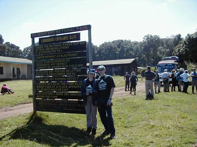
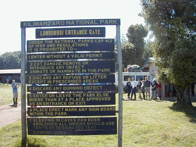
Up at 6am, ready for leaving Ndarakwai tented camp at 8.40am. We saw the first glimpse of snowcapped Kilimanjaro in a haze – it looked spectacular. We drove to Londorosi Gate where we registered for Kilimanjaro National Park.
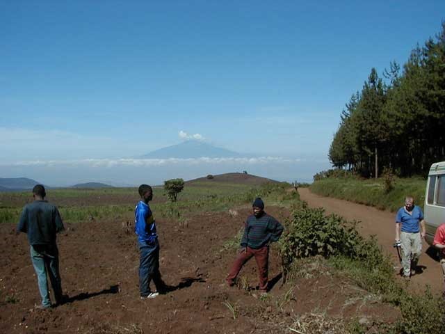
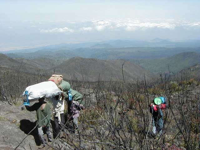
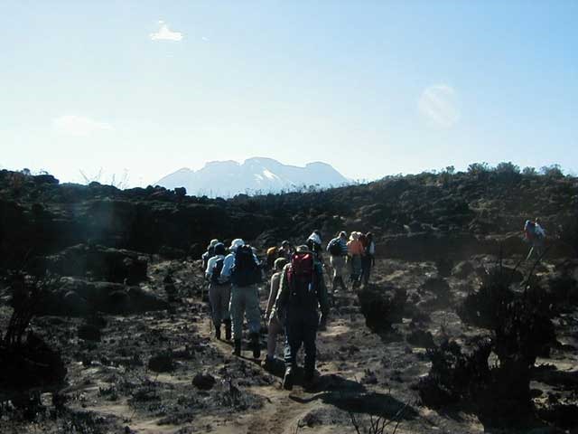
After our first meetings with the locals we drove for another hour as though we were on safari (without the game) until the road ended, which marked the start of the Lemosho route. This was to be the start of our wilderness trek up through the rainforest.
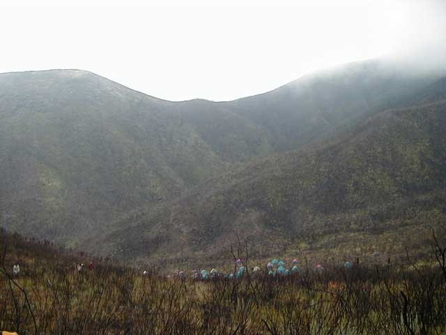
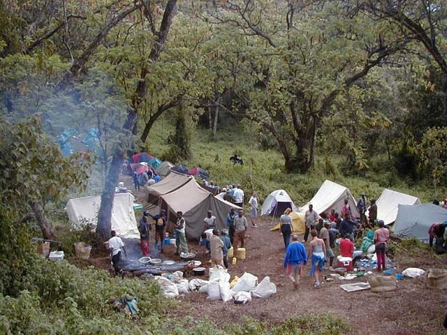
We walked up through the rainforest where we had lunch and continued on to our camp at 8120 feet. To begin our altitude training we were to take a walk through the dense foliage of the rainforest (where we saw a couple of Colobus monkeys) to a higher altitude and then come back to camp lower.
After a wonderful spaghetti and stew meal we spent the evening around the campfire, and went to bed at 8pm. It was a very intermittent nights sleep even though it was lovely and warm in the down sleeping bag, although this could have been due to the noise from hyaxes and monkeys throughout the night.
Sunday 20th September
G & M 1 – 9,630ft
Up at 7am, and after getting packed away breakfast was at 7.45am, which consisted of toast & jam, porridge, and egg on toast. Beautiful !! Started on trek at 8.45am and took the same route through the rainforest as the previous afternoons acclimatization walk. Continued on up past another camp at 9000 feet, and on to our lunch stop at midday.
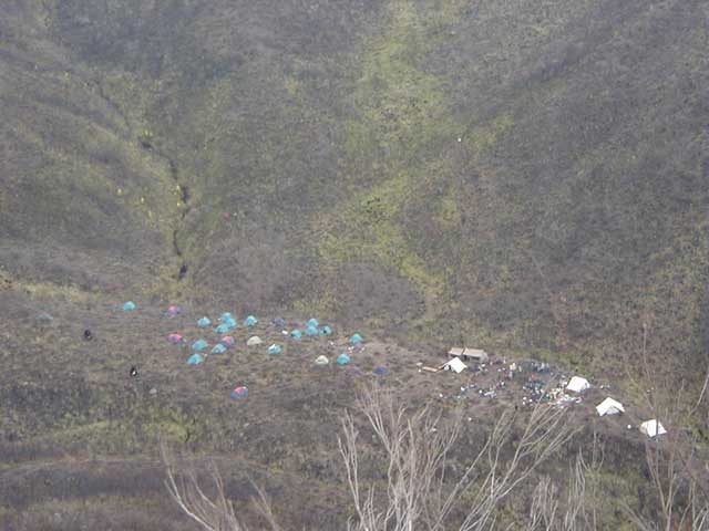
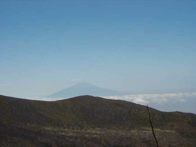
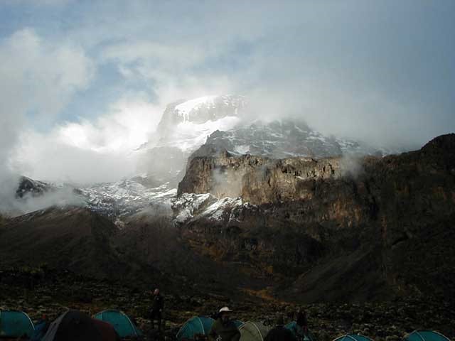
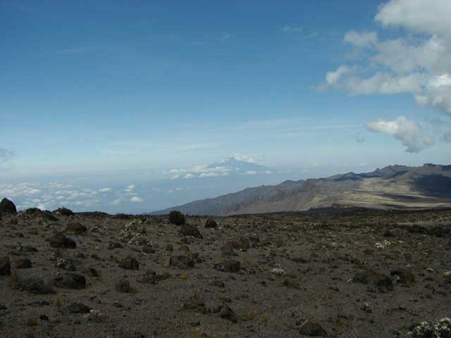
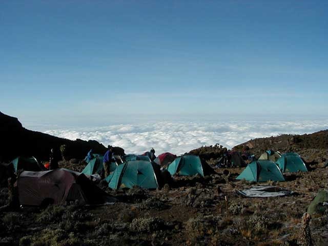
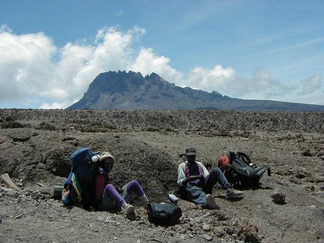
Got to our final destination camp at 9630 feet known as “G&M 1” at 1.45pm which was situated just below the Shira Plateau in a valley. It was very scenic but started cloudy. We went for another 1 hour walk up another 500 feet to the top of a hill where we had a very good view of Mount Meru and Kenya in the distance. Mount Meru was shrouded in cloud but still looked absolutely massive at 4565 meters high.
This evening was Trevor’s birthday (Fundraising officer for Butterwick Children’s Hospice) and the porters had a cake made for him, which was surprisingly good considering the environment we were in. Bed was at 10pm and another bad night sleep was had after something climbed into bed with me and decided to feast on me.
Monday 21st September
Shira Plateau Camp – 11,200ft
Packed everything away, including a damp sleeping bag ! Breakfast as usual was porridge, toast & bacon which was very good. We left in the first of 3 groups at 8.45am on the same route as the previous afternoon but turned right leading towards Shira plateau.
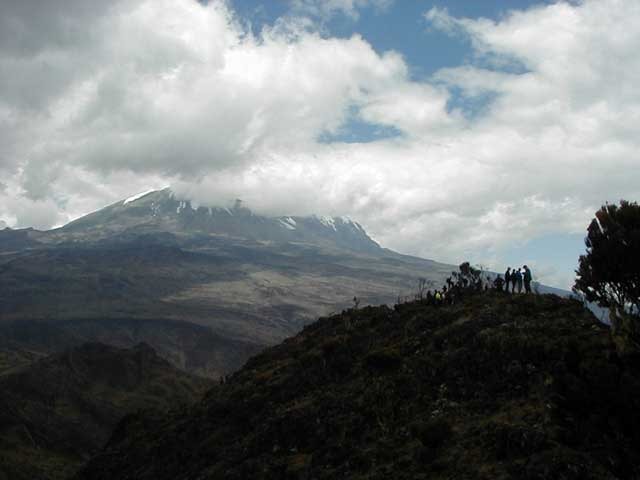
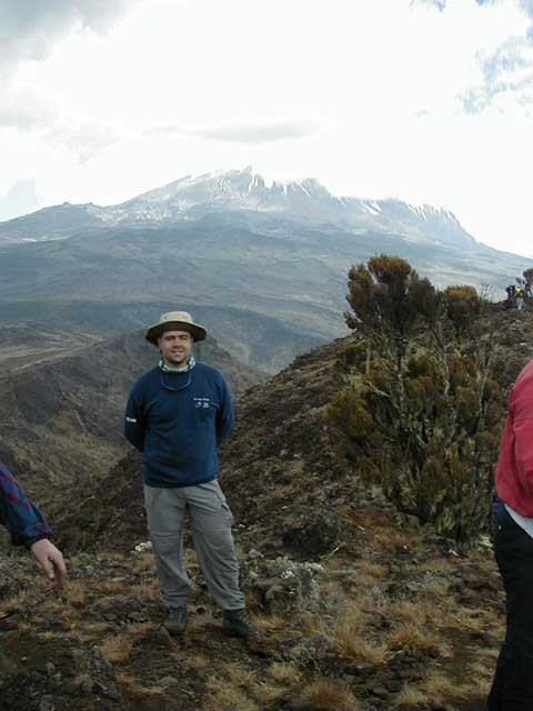
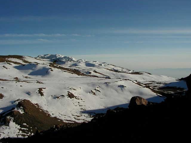
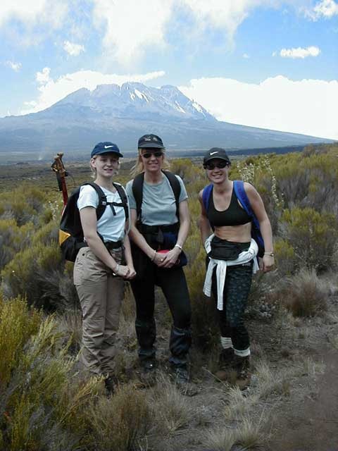
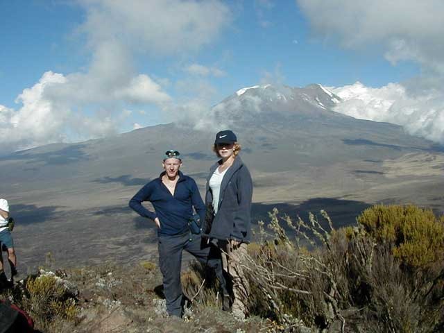
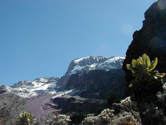
En route around the caldera we saw our first glimpse of Kilimanjaro, and once on Shira plateau we saw it in all its glory – snowcapped and awesome.
We got to camp for lunch at 1pm and headed off at 2.05pm up to Johnsels Point on Shira Plateau which is the smallest of Kilimanjaro\’s 3 summits standing at 13000 ft. We got to the summit in 2 hours where there were some magnificent views. After half an hour acclimatization we headed down for dinner. Camp was at 11200ft so some good altitude was gained today.
As soon as the sun went down it was absolutely freezing as it has been every night, and its getting colder the higher we go. Dinner was a right mixture with cauliflower, chips, pasta & stew, and straight after we were briefed on the effects and dangers of AMS (Acute Mountain Sickness).. Kilimanjaro looks so close that we could climb it nearly although it is about two kilometers higher than Johnsels Point. Bedtime at 7.45pm shagged out, but whether I sleep is a different matter. End of day.
Tuesday 22nd September
G & M 2 – 12,200ft
Sleep by 9ish and the best night sleep for me, not Sarah. I only woke up a couple of times during the night. It was very cold, hence a good ground frost at 6.30am. We both felt pretty healthy today and I began to feel very good at last about the climb to the summit. Breakfast at 7.45 as normal ready for an 8.55am departure to Shira Cathedral across the plateau. As soon as the sun came up it was very hot. Loads of factor 50 sun cream today.
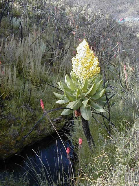
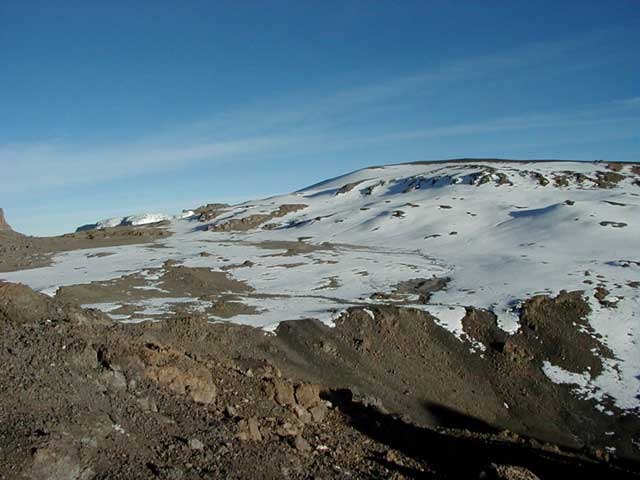
Went across desert like terrain then stopped for a packed lunch at the foot of Shira Cathedral. Lots of shrubs and plants here, even at this altitude. We climbed to top of Shira Cathedral at 12200 feet. Felt pretty good. There were fantastic views over the rainforest, Johnsels Point, Shira Cove, and Shira Needle.
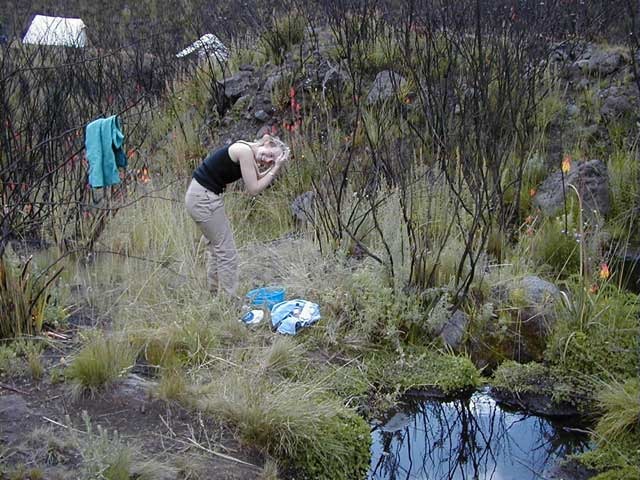
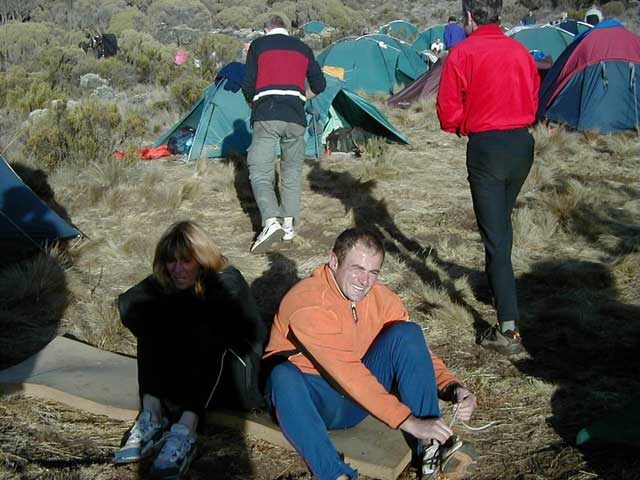
Walked a further 1 1/2 hours to our 12200 feet camp at G&M 2. I felt tired and dizzy by the time we got there and decided on more Paracetamol. We had our first good body and hair wash in a freezing cold stream and started to feel a bit better. Getting there early meant we had a snack and relaxed for the afternoon. We decided to wash trousers – big mistake as we spent the evening trying to get them dry over the campfire.
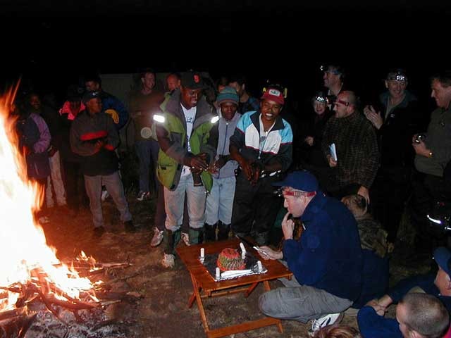
We’ve been lovely and warm every night up to now but tonight was a very cold night, and I slept in long johns, tee shirt and socks. Trevor and Graham gave a talk about the Butterwick Children’s Hospice tonight which was very informative and gave us an insight into what we were doing this sponsored event for. Bed at 9pm – hopefully to sleep !! Tomorrow is the first really tough day.
Wednesday 23rd September
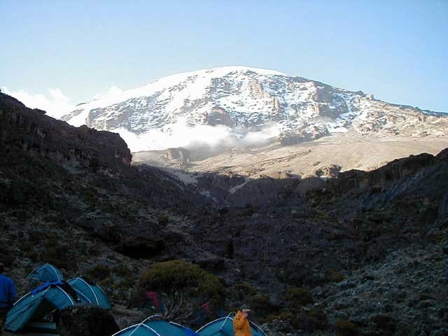
Barranco Camp – 13,000ft
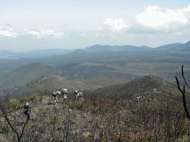
Up at midnight for a freezing cold pee and ended up relaxing for 15 minutes by the remains of the campfire. I awoke at 6.15am feeling fine but Sarah had a headache. This was to be the longest walking day going from 12200 feet up to 14200 feet and then back down to just under 13000 feet – Barranco Valley. Up until now we hadn’t seen anyone else but this was the start of the tourist routes with litter and other trekkers !! We had breakfast as usual and left at 8.55am. The route took us across a barren rocky landscape with low cloud beneath us.
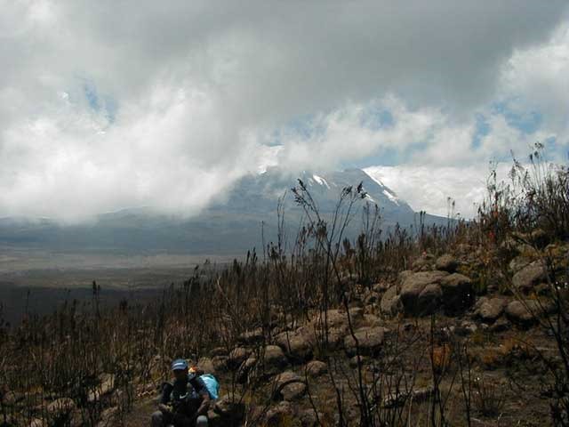
Sarah felt very rough and took her first half of a Diamox altitude tablet just before sitting down to eat. We stopped just beneath the Lava Tower where we had our pre-arranged lunch. On our way to Barranco camp we had our first heavy rain and snow of the trek and ended up using our Goretex waterproofs for the first time. We arrived at camp at 3.15pm, and it seemed as though we were just under the enormous glaciers of Kilimanjaro. I felt rough with a headache and took my first Diamox tablet which eased the pain. In the evening Kilimanjaro completely cleared and it looked very close.
Dinner was the usual soup followed by potatoes, pasta and stew, and then we spent a couple of hours around the campfire. Sarah still felt nauseas but improved as the night went on. This evening was already getting very frosty.
Thursday 24th September
Karanga Valley Camp – 13,200ft
Penultimate summit day. We got up before 7am to a very hard frost. The clear skies gave us excellent views of Kilimanjaro in one direction and thick low cloud covering the plains in another. Breakfast was the usual porridge, scrambled egg and toast.
We set off at 9.30am to climb the 700 foot Barranco Wall which would give us some more acclimatization. It looks like a sheer rock face from a distance but there is a relatively easy path leading to the top.
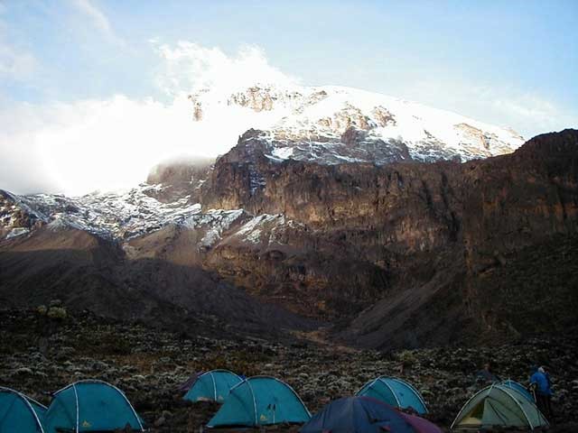
After going up and down a couple of valleys we reached our next camp at Karanga Valley with awesome views of Kilimanjaro. Camp is at 13200 feet with an afternoon climb / scramble up to 15000 feet. This was to be a very tough uphill slog as every two steps forward usually ended up with one step back, although once at the top there was an easy downhill scree slope run. It was a lot further than it looked, but got us to just below the start of the glaciers.
We got back down for dinner and had a briefing on summit day which was to be the hardest day.
Friday 25th September
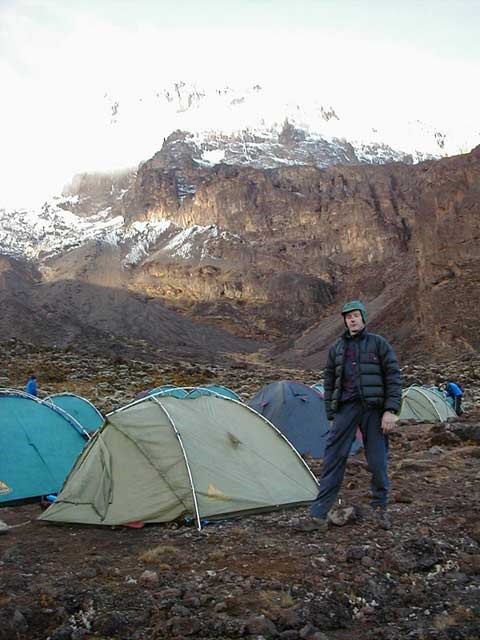
Great Barranco High Camp (G & M) – 16,000ft
Up at 6am and as it was so early I ended up making the campfire. We had another good night sleep in Karanga Valley, but another very cold morning. We started up the Karanga Wall after breakfast at 9am which led to us going up and down more valleys (although more ups than downs!). Sarah had her first attempt at walking poles as they would be greatly needed on summit night, and with the long descent that we inevitably faced.
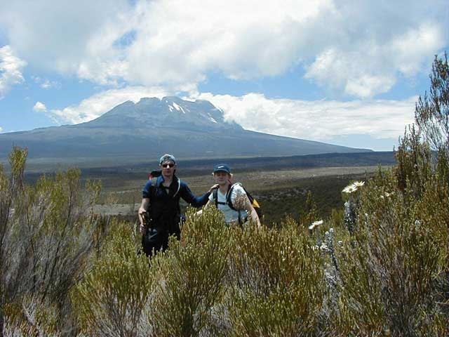
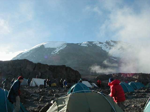
Some major height was gained today as we started at 13200 feet in the morning and were to finish at 16000 feet at Gane and Marshall\’s Barranco high camp. This was a long arduous trek going up towards Kilimanjaro but it meant that we had a slightly shorter summit ascent as we were camping higher than most other groups who attempt Kilimanjaro.
Diamox is working well for me but not so well for Sarah who was ill, nauseas, lightheaded and breathless for the last hour or so to the high camp. My face is sore, dry, sunburnt and has a couple of blisters – but otherwise OK !! I got into a good rhythm today in preparation for later on in the evening. We got to bed at 6pm as we had to be up at midnight for the summit.
It looks so close now and we should hopefully be up at Stella Point in 5-6 hours, and Uhuru Peak a further 1 1/2 hours later.
Saturday 26th September (Summit Day)
Mweka Camp – 12,000ft
We awoke at 11.30pm and got ready to go. We both felt up for it and got loads of layers of clothes on as it was to be a very cold night with temperatures down to around -10°C. Sarah made us both a hot drink and just about passed out with altitude sickness – that was to be the end of her summit attempt on the doctors and Geremy Gane’s advice.
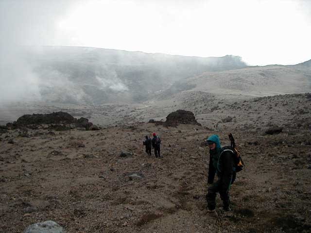
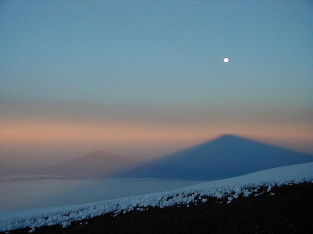
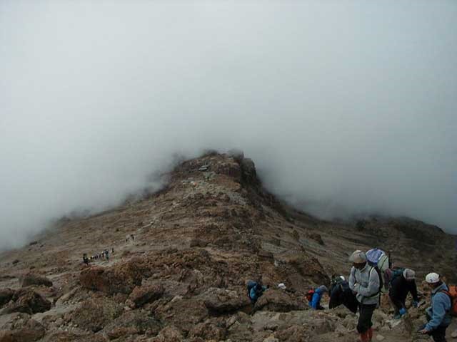
I started at 12.30am with the rest of group 1 from Barranco high camp at 16000 feet, and straight away it was a slow steep slope. My fingers kept going numb with the cold and my feet were a bit nippy. After plodding on for 4 hours and 45 minutes we finally reached Stella Point at 5.15am in the dark. The going was rock and scree all the way up, and was made all the more difficult by only having a couple of swallows of hot water to drink – the pipe of the platypus water carrier I had was frozen solid!
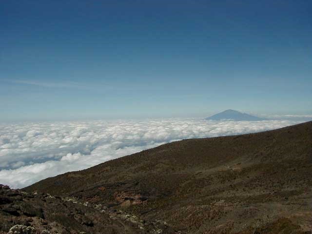
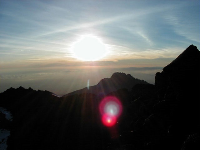
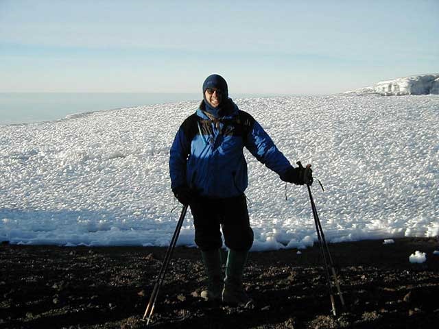
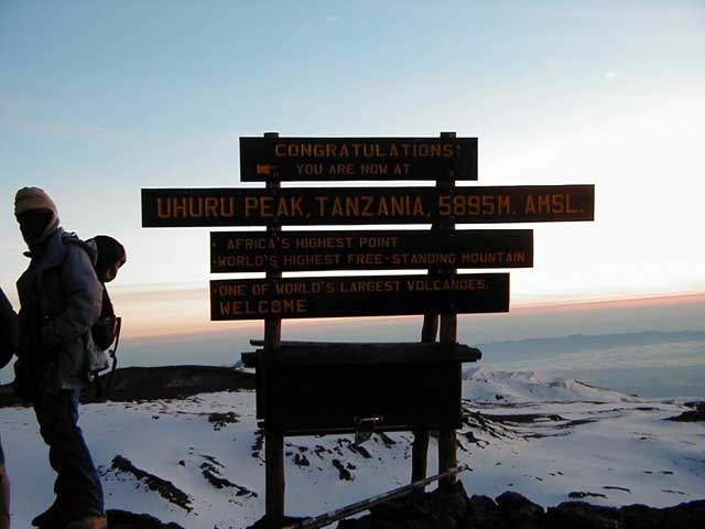
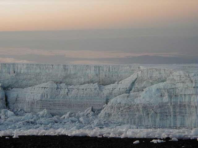
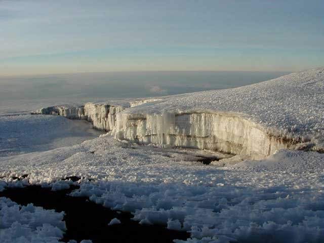
The site at the top inside the crater was huge with vast areas of snow and ice. Out of the 12 of us in group 1 only four of us continued up to Uhuru Peak (the highest point). This is normally a one and a half hour walk but we got there in 45 minutes just as the sun was coming up, with spectacular views of glaciers and the crater. There were only 2 other people at Uhuru Peak when we got there and it was -10°C.


Loads of photos later we headed back down to Stella Point and our way back to camp. I was back at camp by 7.30am, some 7 hours after we left absolutely knackered and thirsty. The scree-skiing back down was great and the unfrozen drink back at camp was even more appreciated. A real personal achievement for me, though Sarah said she felt like a failure – nothing could be done about it as she gave it her best shot. Hopefully we’ll be back to do it again.
At 9.30am we left on the way we had come the previous afternoon but continued on into the bush to Mweka hut at 12000 feet, where we camped for the night – they had beer there – fantastic and well deserved ! I was asleep by 4.30 in the afternoon and Sarah bought me dinner, after which I fell straight back to sleep. The next day was to be a very early 5.45am start with a 4 hour downhill to Mweka Gate.
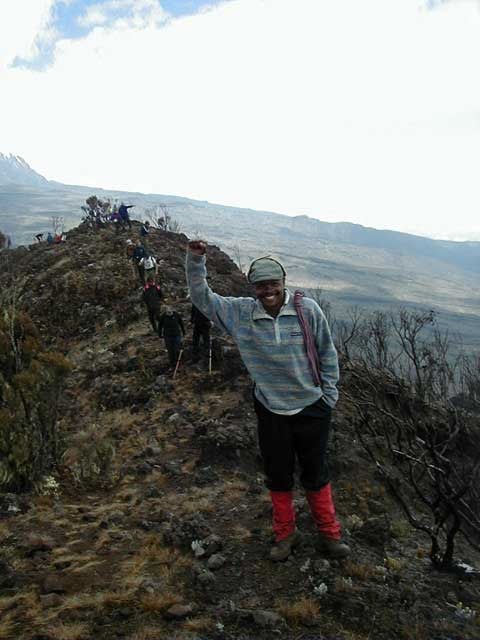
The day was a total success with some awe-inspiring views, but very tiring. No Paracetamol were taken either, but loads of photos. All the guides and Geremy Gane were very good to us. Out of the 45 of us 42 made it to Stella Point and a further 20 to Uhuru Peak.
Sunday 27th September
Ndarakwai Tented Camp
Up at 5.30am for the long downhill walk to Mweka Gate. This should take about 4 hours but we were down the very slippery winding slope through the rainforest in 3 hours. We saw loads of black and white Colobus monkeys.
Once at Mweka Gate we signed out of Kilimanjaro National Park, and Geremy had a presentation for the best 3 porters and they all looked so happy. The guides and porters were a fantastic crowd – great fun and very helpful. We all tipped $100 US each for their help. The head guide – Joachim, who’s been up Kilimanjaro over 200 times was excellent, as well as Sam (from Gane and Marshalls office in Arusha) who was also very friendly. Top marks.
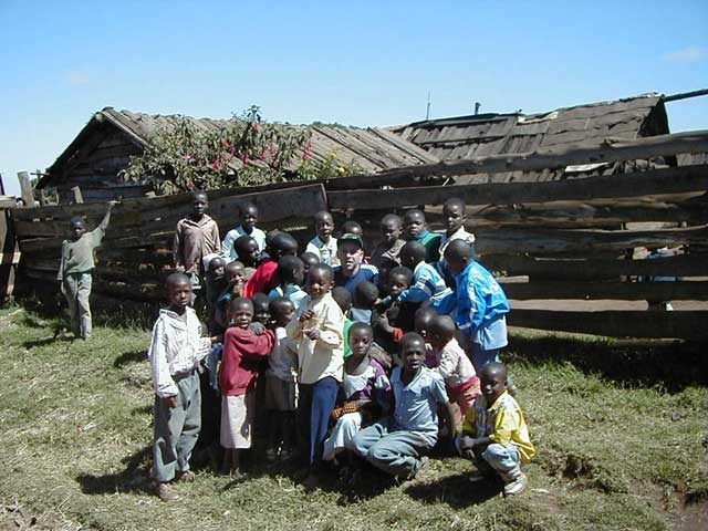
It was quite emotional seeing the porters getting their gifts and they applauded us and we returned it and congratulated them with 3 cheers. We will definitely come back here. I gave a couple of local children some pens, playing cards, etc… and their faces lit up with excitement.
After walking to the village to meet up with our buses we got to Ndarakwai tented camp at 4.45pm for the first shower in 10 days – Fantastic !! The sunburn has made me look a right state but who cares. A load of beers later it was off to bed at 11.30ish. A decent dinner and some good words from Geremy and Trevor made the evening.
Monday 28th September
I was up at 6.15am for a walk into the bush, whereas sensible Sarah stayed in bed. It was worth it as we saw a herd of elephants, baboons, and Eland. After a nice breakfast of fried eggs, sausage and bacon we departed Ndarakwai tented camp and it was off for a 3 hour drive to Arusha town for the rest of the day.
Sam took us to Gane and Marshalls office, the market where they stock up for all their treks, and various other places. We had our first decent western meal, where most of us went traditional and had the ostrich steak and a couple of beers.
Off to Kilimanjaro Airport, and our departure to Manchester via Dar Es Salaam, and Amsterdam.
Statistics
About Kilimanjaro
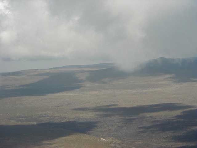
Mount Kilimanjaro, the highest mountain in Africa, the highest free-standing mountain in the world, and one of the largest volcanoes ever to break through the earth’s crust. Seen from a distance it looks as though it is sitting on the clouds. Although only three degrees south of the equator, glaciers and snow cover its peak. Almost four miles high, it can be seen on a clear day from more than one hundred miles away. And this is not all: within its one great ecosystem lies almost every kind of environment found on earth. In the space of a few days you will pass, as it were, from the equator to the Arctic: through tropical rain forest, Alpine meadows, moorland, desert uplands, to snow and ice. We can trace the grand process of evolution in reverse: from the animals of the forest to the first stirrings of bacterial life on the summit.
Kilimanjaro National Park takes in the area above 8,850 feet, or 2,700 meters, on the mountain. It includes the moorland and highland zones, Shira Plateau, Kibo and Mawenzi peaks. In addition, the Park has six corridors or rights of way through the Kilimanjaro Forest Reserve. The Forest Reserve, which is also a Game Reserve, was established in 1921; the Park was established in 1973 and officially opened in 1977.
Kilimanjaro stands a scant 205 miles south of the equator, on the northern boundary of Tanzania. Its location on an open plain close to the Indian Ocean, and its great size and height strongly influence the climate, vegetation, animal life and the climbing conditions. It is made up of three extinct volcanoes: Kibo 19,340 feet (5,895 meters), Mawenzi 16,896 feet (5,149 meters); and Shira 13,000 feet (3,962 meters).
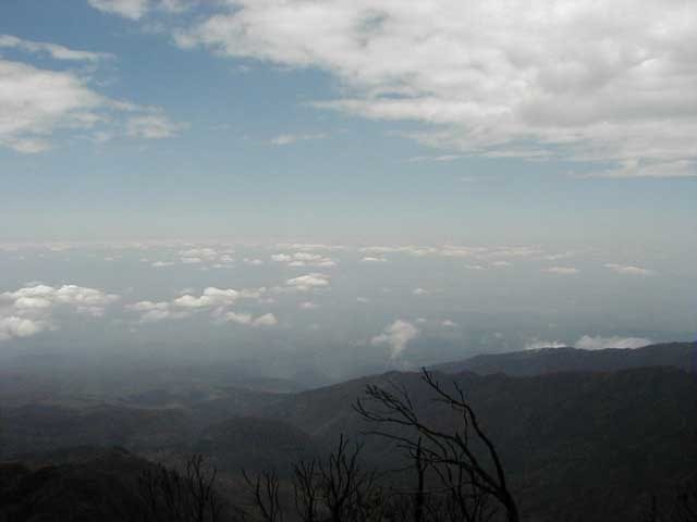
Equatorial to arctic conditions are present on Kilimanjaro. The range begins with the warm, dry plains with average temperatures of 85°F, ascends through a wide belt of wet tropical forest, through zones with generally decreasing temperatures and rainfall, to the summit where there is permanent ice and below freezing temperatures. The rainiest period is March to June. The fact that most months of the year have so few rainy days makes it possible to climb in relatively good conditions year round. During the rainy period of March to May, clouds tend to pile up and over the summit, dropping snow on top and rain at the base. Visibility can be limited by cloud cover even when no rain falls. The temperature at this time of year is relatively warm. The dry season, beginning in late June and through July can be very cold at night, but usually is clear of clouds. August and September are also cool and can have completely clear days, but usually a dripping cloud belt girdles the mountain above the forest and moorland. The summit can be totally clear and the successful climber looks down on a vast sea of clouds with distant mountain peaks poking through like islands. The shorter rainy period of October to December often has thunderstorms that pass over the mountain, dropping rain as they go. Typically the clouds disappear in the evening, leaving nights and mornings clear with excellent visibility. January and February are usually dry, warm and clear with brief rain showers which make for good climbing conditions.
Kilimanjaro towers above the Great Rift Valley, possible birthplace of humankind and the site of the Leakey’s research in the Olduvai Gorge. This gives Kilimanjaro an awesome mystique. One can imagine the mountain towering above our ancestors, making an early, continual impression on the species. When you walk the mountain, you\’ll probably encounter some odd, purposeful arrangements of stone. Your guides will claim to not know what they mean. Perhaps they don’t.
Route to the Summit
The route that we took to the summit was a wilderness route mostly devised by Gane & Marshall. The idea of this route was to give us more chance to see the surrounding area around Kilimanjaro, and to take in the different flora and fauna.
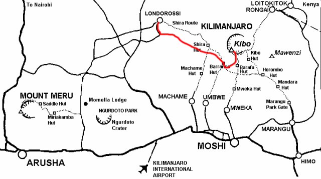
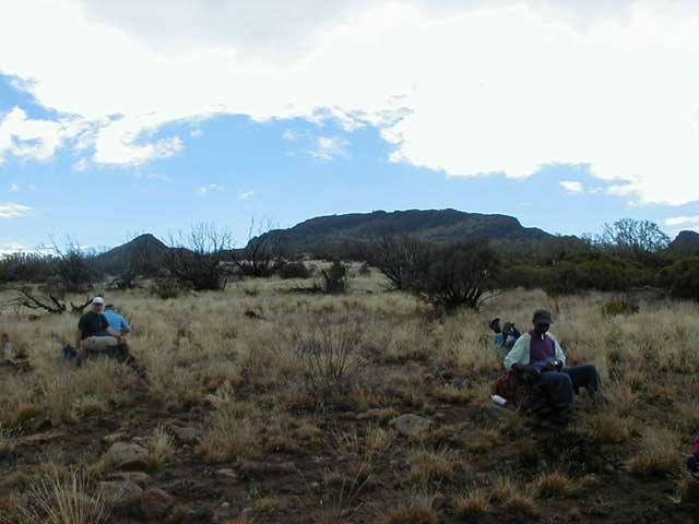
The Lemosho Route starts on a little used and very pretty track through the western rain forests where wildlife is in abundance – we had to have an armed guard for the first section of the walk to ensure we were safe from elephants and buffalo. As it happened we didn’t see any but their droppings were everywhere. This then leads onto the west of Shira. Once upon Shira Plateau there are various acclimatization walks, including Johnsels Point and Shira Cathedral which all add to the chances of reaching the summit. From Shira we trekked towards the Lava Tower which led us to Barranco Camp, and from there onto Karranga Valley, beneath the icefalls of the Heim, Kersten and Decken Glaciers. Our last night before the summit was spent at 16000 feet at Great Barranco High Camp.
This ascent offers a higher altitude summit camp than any other route, giving a shorter night walk on summit day up to Stella Point on the edge of the Kibo Crater between the Rebmann and Ratzel Glaciers, and a chance to cross the crater, visit the ice walls and summit glaciers, before climbing the inner rim to the summit – Uhuru Point.
The descent was via the Mweka Route which is a very direct and fast way down the mountain providing limited views across the Southern Glaciers. The track in the forest is often impassable even to 4WD vehicles. Beyond the roadhead the path is steep and slippery in parts. Above the Mweka Huts water must be carried. Sometimes a long walk is required at the Barafu Hut to find snow or ice for water.


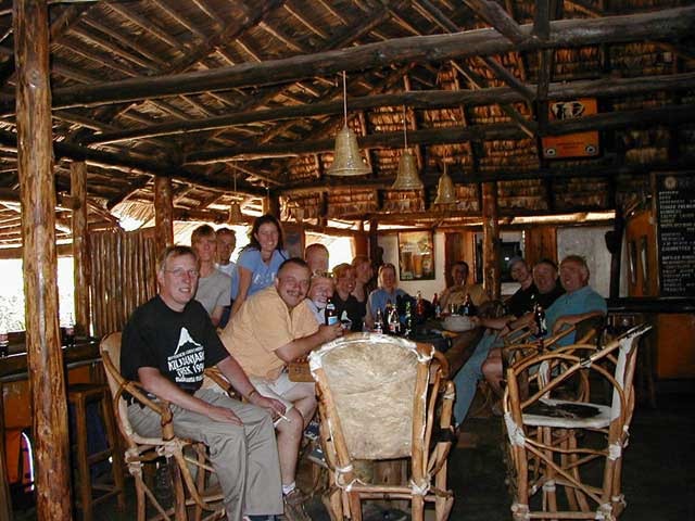
The Team
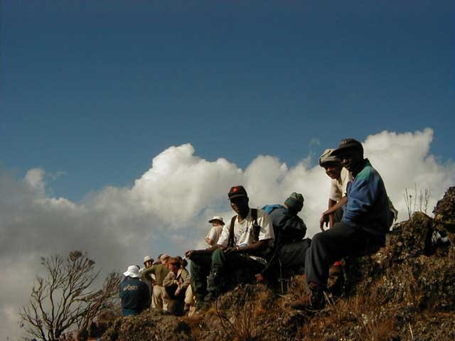
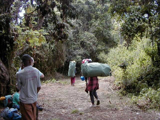
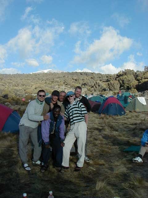
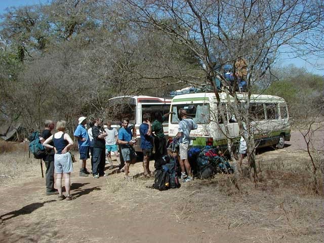
The Butterwick Children’s Hospice team consisted of a very mixed group of 45 people ranging from 17 years of age up to people in their early fifties. Mainly coming from the North-east of England, around Stockton-on-Tees and Middlesborough, although myself and Sarah are from Leicester in the East Midlands and there were a couple from Edinburgh. We all came from different backgrounds, including doctors, policemen, accountants, and a pathologist !! It was quite fortunate that we had 5 doctors with us as we were quite a large group, and along with us there were approximately 107 porters and 12 guides, as well as Geremy Gane (the tour leader) from Gane and Marshall, Tim Calder who is to take over from Geremy and Steve Dawson from Classic Tours who organize the charity events.

The group members were all fairly fit, but some more so than others so we were split into 3 groups, supposedly with the slowest in the first group and the quickest group leaving the campsites last. It seemed though that all 3 groups were evenly split, especially on the days leading up to the summit when everyone was walking slowly anyway. Out of the 45 team members 42 made it to Stella Point on the crater rim and a further 20 made it up to the highest point in Africa – Uhuru Peak
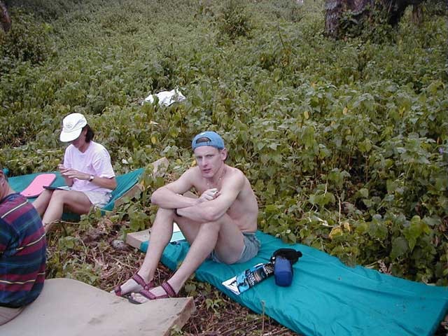
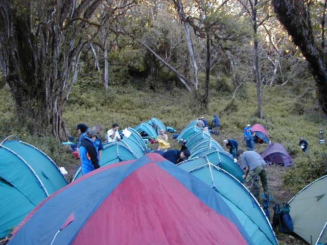
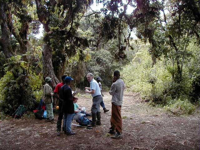
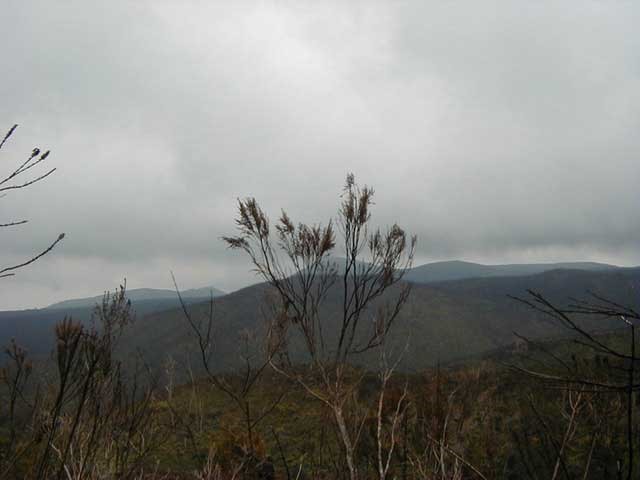
Photo Gallery