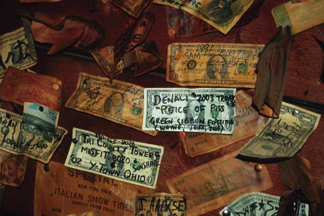
DENALI
Climb Stats
7 Summit Number: Four
Location: Denali National Park, Alaska
Altitude: 6,194m / 20,320ft
Date Summited: June 21st, 2003
Guiding Company: Mountain Trip
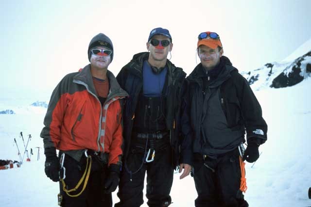
Guides: Chris Kerrick, Zach Schlosar
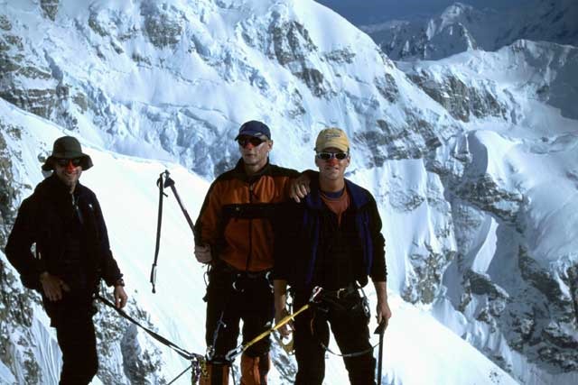
Climbing Partners: Jeff Strite, Jose Rionda

The summit of the North America continent
Info
Denali is the highest mountain peak in North America, with a summit elevation of 6,194m (20,230ft). At some 5,500m (18,000ft), the base to peak rise is considered the largest of any mountain situated entirely above sea level. Measured by topographic prominence, it is the third most prominent peak after Mount Everest and Aconcagua. Located in the Alaska Range in the interior of the US state of Alaska, it is the centerpiece of Denali National Park.
Itinerary
Thursday 5th June
Departed London’s Heathrow airport for the long journey to Anchorage, via Chicago. I met Jeff as agreed in the bar at O’Hare airport and we had a couple of beers and continued drinking the plane dry during the 6 hour flight to Anchorage! Within an hour of arriving we were in Humpy’s bar in downtown Anchorage, and coincidentally we were having a meal with the aircrew from our flight. Soon after our arrival Jose walked into the bar and we had an excellent reunion night out – the last the three of us saw each other was the previous February in Chile.
Barbara was our friendly host from Inlet B&B where we were to be staying for the next 2 nights before departing for Talkeetna, and we were given the run of the house.
Friday 6th June – Day 1
This was officially the start of the expedition where we will hopefully traverse the highest mountain in North America known as Denali or Mt McKinley.
The team meeting was at noon and we met our fellow mountaineers, the 3 guides and the Mt Trip proprietor, Gary Bocarde. The schedule was discussed and other important information regarding the trip, and soon after we had our gear check so as the guides could advise on our equipment, what we should leave behind and any new purchases that we would require.
In the afternoon we made a trip to REI and Alaska Mountaineering & Hiking to make the necessary last minute purchases – I spent another $330 that I hadn’t budgeted for, but everything was vital for our own safety and comfort on the mountain.
Again, we spent the evening in Humpy’s!
Saturday 7th June – Day 2
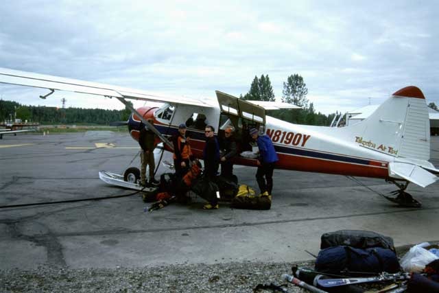
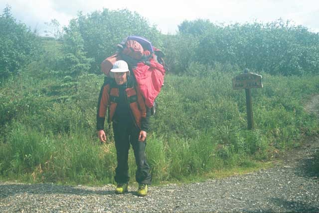
The shuttle to take us to Talkeetna arrived at 8am and we loaded all of our personal gear and the duffels of group gear into the trailer. Off we went then to collect more climbers heading off to the airfield in Talkeetna, including 3 Swedish guys and an Austrian chick – she certainly made the two and a half hour trip more interesting!
Upon arrival we went straight to the airfield to offload all the gear and then headed over to the NPS offices to register for the expedition and cough up the $150 fee, mainly used for maintaining the mountain and covering rescue costs. We then went through crevasse rescue techniques at the TAT bunkhouse by attaching ascenders to the already hanging ropes, and roping up with our harnesses, and a foot loop using a tibloc. These were skills that I hadn’t used before so would hopefully assist in any falls we may incur once out on the mountain.
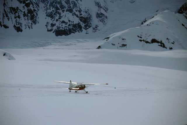
We were scheduled to fly onto the Kahiltna glacier today to basecamp but there were people milling around that had already been waiting for 3 days, so obviously this backlog had to be cleared before we would get to depart. At the airfield our flight company, Talkeetna Air Taxi had started ferrying people out to basecamp as the weather was not too overcast, although we were scheduled last at about 7.30pm. Just as we were about to get onto the 2 single prop planes the flights were stopped as basecamp had become too cloudy to land. All our kit had to be removed and the AMS team already in the air turned around and returned to the airfield.
We unpacked our sleeping bags and set up for the night in TAT’s bunkhouse at the airfield. Food and drink then beckoned and we headed into the small center of Talkeetna – pitchers of beer were on the menu at the Fairview Inn so these were taken advantage of, then food was ordered over the road at the West Rib. Tonight we really noticed the long hours of light and at midnight we had photographs taken in broad daylight!
Sunday 8th June – Day 3
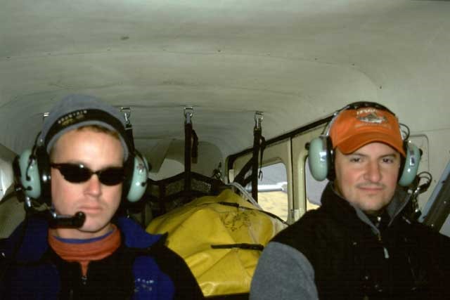
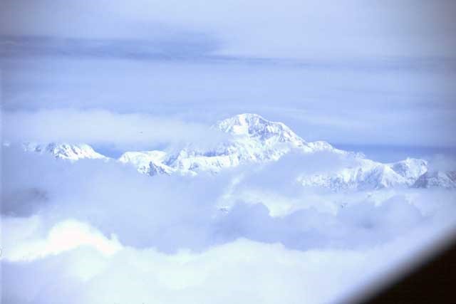
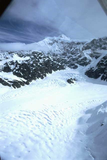
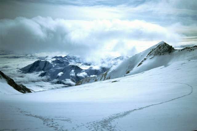
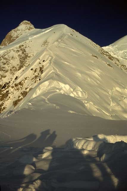
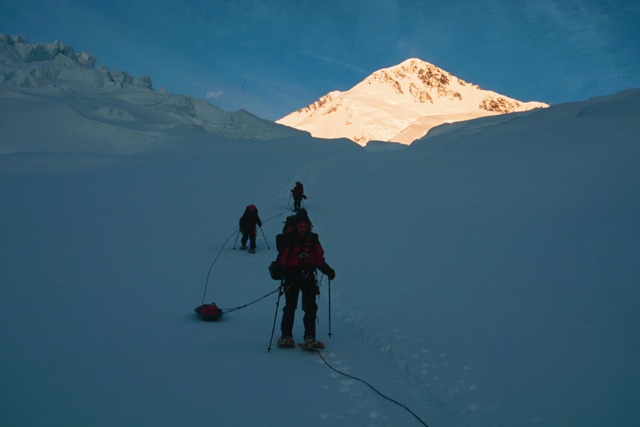
After a hearty cooked breakfast at the Roadhouse we headed back to the airfield for the flight onto the glacier – this time we had success and after returning from dropping AMS off we boarded the two 5 seat Beaver aircraft, and 40 minutes after departing we landed on the Kahiltna Glacier at 7,200ft. The flight was amazing, although cloudy, and when we got into the mountains the scenery was outstanding. We saw the peaks of Foraker and Hunter and then came into view the tallest of them all, Denali, and below us we followed the massive crevasse ridden Kahiltna Glacier, I think about 50 miles long.
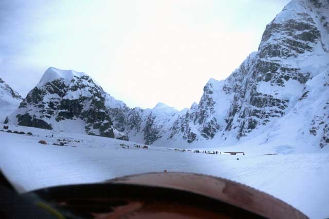
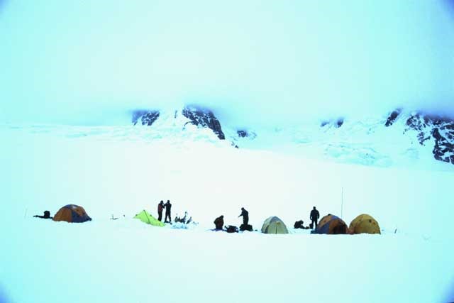
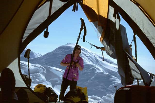
Basecamp was not as I expected, it was set on a slope on the glacier, and was surrounded by enormous snowy peaks with cornices and seracs that looked like they could avalanche at any moment. As we were now significantly higher you could feel the intense sun burning through the clouds, and it was definitely a case for wearing glacier glasses from now until we left for the tundra on the north side of the mountain.
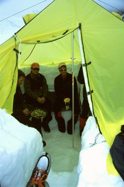
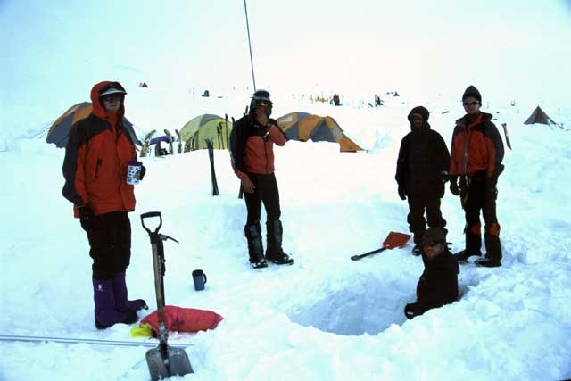
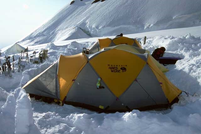
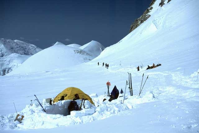
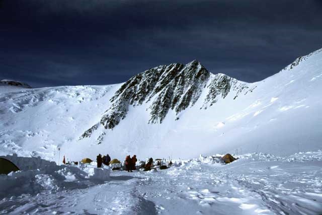
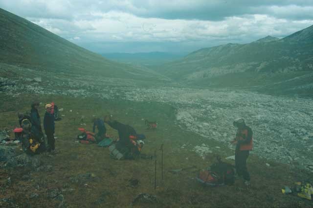
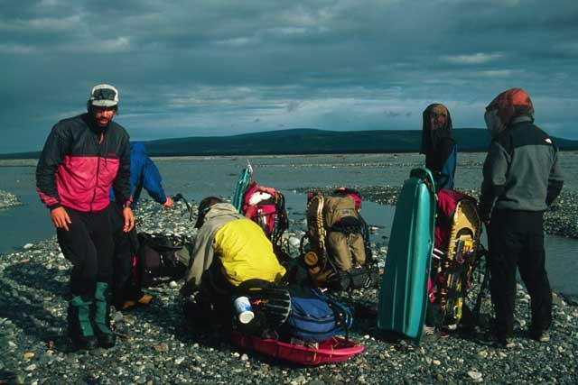
We set up 4 tents for the team and started to excavate the kitchen tent which was basically a 5 foot deep hole with a canopy over the top, and these added to the 20 or so tents that currently make up basecamp, with the addition of the NPS ranger tents – these are used to coordinate rescues, organize flights into and out of the glacier, medical reasons and for reporting weather.
During the morning we witnessed a massive avalanche on the lower part of Foraker – this is an amazing experience to watch and makes you realize how dangerous the mountains can be.
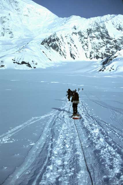
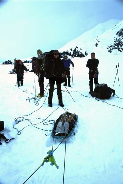
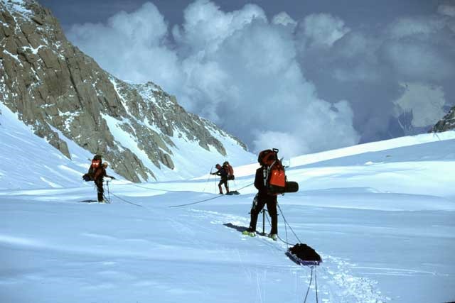
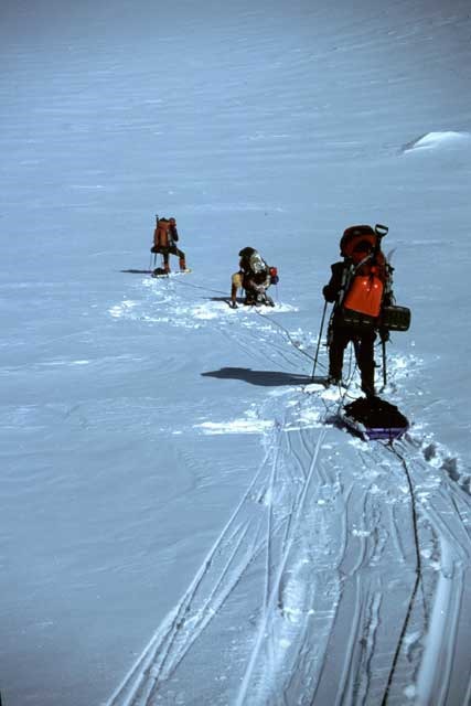
Today was also our introduction to sled setup and rope travel techniques – we were shown how to rig the cheap plastic sleds and attach them to our packs, and how to tie into a rope for the many days of glacial travel ahead of us.
Monday 9th June – Day 4
It was an early start for the hike up to camp 1 at 7,800ft, and as normal we are awoken when hot water is underway. It was a beautiful clear morning with cloud on top of the surrounding peaks.
The expedition was to start with a very tough day in that we have to single carry everything up to camp 1, but with an incline of only 600ft the altitude gain is small. The packs were very heavy and with the exception of the back person everyone in the 3 rope teams had to pull a sled – fortunately I was at the back of the second rope team.
An early start was made whilst it was still a fairly cold 30°F outside, hence giving hard snow conditions and more stable bridges over any crevasses. The travel was undulating with a nice downhill to start with, known as Heartbreak Hill (climbers who return down the West Buttress have to come up this hill to finish their climb). Today’s rope teams were:
Chris, Andy & Wayne
Zach, Jeff & Jose
Andre, Greg, Miles & Nick
We stopped on an hourly basis for food and water, which will be the pattern for the entire expedition. It was approximately three and a half hours up to camp 1 in mostly a whiteout.
When we arrived the proposed campsite was probed for crevasses prior to us moving into the marked area and unclipping from the rope. Then as normal we pitched the tents and started digging the kitchen out.
It is quite amazing being out here in the land of the 24 hour daylight, and finding that it is remarkably easy to sleep, even when the sun is still shining in through the tent window – I guess this is through tiredness and being in fresh air all day!
Tuesday 10th June – Day 5
Another early start with a carry up to our cache site at 10,200ft, just below our camp 2 location at 11,000ft. All food and unnecessary personal gear was taken up with us so the packs weren’t too heavy today, unlike yesterday!
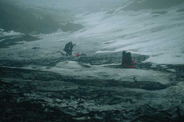
The terrain was far steeper as the height gain was 2,400ft, where this part of the West Buttress route is known as Ski Hill. The first part was very cloudy and it soon turned into a complete whiteout and you couldn’t tell the snow from the white sky – an amazing experience. Added to this was the snow and sleet that was falling which seemed to make it a little cold, although the weather in general was somewhere between 32°F and 50°F since we had been on the glacier.
It took us somewhere between 3 & 4 hours and thankfully wasn’t too strenuous a day – again I didn’t have to pull a sled!
Andy from the UK was struggling at this early stage and this ended up being his last day of ascent so early in the trip – and that was without bringing the heavy tripod he was going to bring along! Andy just hadn’t anticipated how tough it would be and the weight of the packs with sleds. We had already lost Brendan as he didn’t even make it out of Anchorage – “Been there, done that” was his comment, and he quit there and then! Strange!
For the cache we had to dig a 4ft deep hole, mainly so it was buried out of reach of scavenging crows that have been known to dive bomb buried caches – they recognize the marker wands with food and dig it up if it’s not buried deep enough!
After an hour at 10,200ft we headed back down with me at the front of the rope team of three, this is normal procedure to reverse the team on the descents. It took us about an hour in improving conditions, and en route we could see silhouettes of enormous snowy peaks to our left and right, and then in the distance were the dots of our tents among other expeditions and private climbers.
Tomorrow was to be the move up to camp 2 at 11,000ft and the start of the more technical climbing.
Wednesday 11th June – Day 6
Up at 4.45am and everything had to be packed away ready to move camps. This was a gloriously clear day, unlike yesterday’s whiteout. I decided to go in the center of the rope team today and sled haul which meant that the pack was a bit lighter but pulling the sled felt more strenuous.
Another loss today as Andy had already decided that he would go down, but joining him was Miles who supposedly pulled something in his back – Zach and Andre were accompanying the two of them back to basecamp and then returning to meet us up at camp 2 the following day. This left us with only five climbers! Jose, Jeff and I were still going strong!
The sleds were made up with a rope braking system for downhill travel – whilst I was pulling the sled the rope went underneath when I was going uphill, hence adding a lot of resistance to the sled. I was worried about how hard it was up to the point where we dropped our shitbag in a crevasse and Chris yelled to me that the brake was on on my sled – once I changed the system the pulling was significantly easier!
Within a couple of rest stops we were passing the point where the day previous we had made our cache, and from there we went into a fairly steep final 900ft of ascent – this drained me!
The altitude change could be felt up here as when I was digging the kitchen tent out and leveling the tent platforms getting out of breath happened much quicker. As there were only six of us up here preparing camp took much longer and more effort than usual – 8pm and tired! It was also a very hot and sweaty day which made things far harder, especially with sweat running down into your eyes and glacier glasses.
Thursday 12th June – Day 7
The two guides returning from their trip to basecamp at 8am woke us up although a lay in was scheduled for today as all we had to do was retrieve our 10,200ft cache. Bacon and egg bread was for breakfast – beautiful!
Two teams of 3 on the rope teams and a fast descent to the cache was made. After digging it up we packed our empty packs – these ended up being very heavy again as were carrying the food for the whole expedition, but still more comfortable than hauling a sled. I led the second rope team back up the hill, with Jeff and Jose, and it wasn’t long before we met some Alaskan climber friends at their camp where we were offered Canadian Whiskey – this was devoured, and just past them was another guy who offered us Scottish Whiskey – what a day! This certainly spurred us on and we soon caught up with other team.
We arrived back at camp 2 at about 2pm and chilled for the rest of the afternoon. It was a fantastic day with mostly clear skies and sunshine, although the wind has just started getting up outside tonight and the higher we get the worse it will become.
More nice food was served by the guides, a good bunch of lads, and now we are only five it feels that we should be successful! As none of our guides have done the traverse before either it makes it important for us to succeed – Chris has attempted it before but bad weather has always thwarted his teams chances.
We have met a friendly crowd on the mountain, including bumping into Howard (from our 2002 Aconcagua expedition) in AMH, then again on the mountain. Then Kit from our Aconcagua expedition at breakfast in Talkeetna, and also working with RMI on the mountain. There have been a lot of people heading down today as the weather up high is bad at the moment, where some of them have been up at 17,200ft for 5 days.
Tomorrow the plan is to carry a cache up past Windy Corner to 13,500ft, via Motorcycle Hill and Squirrel Hill.
Friday 13th June – Day 8
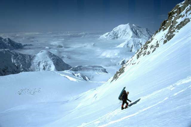
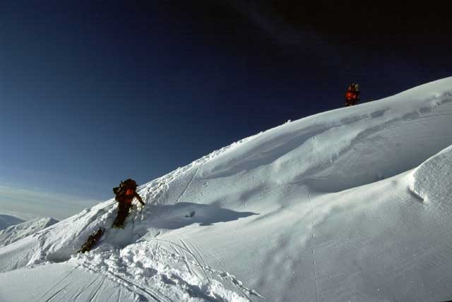
From now on we will be wearing crampons as the terrain becomes much steeper and icier. The first part of the ascent up Motorcycle Hill was fairly steep and chilly – at the top as the sun came over the hill it became warmer and clothing layers had to be removed. Around a bend to the right led us onto Squirrel Hill which was even steeper.
The trail was almost empty this morning which was fantastically clear. From the top of Squirrel Hill it became much flatter and we had our usual hourly stops. This last leg which led up to Windy Corner I found very long with a steady hill towards the end. Windy Corner didn’t quite live up to expectations as there was no wind – just an awesome view of the Alaska mountain range.
We cached our loads and set off back down the mountain to 11,000ft. At the top of Motorcycle Hill we stopped for a view of the Father & Sons Wall and long drop-offs back down to the glacier below. Camp looked so small, even from where we were but we traveled swiftly down and arrived safely.
Saturday 14th June – Day 9
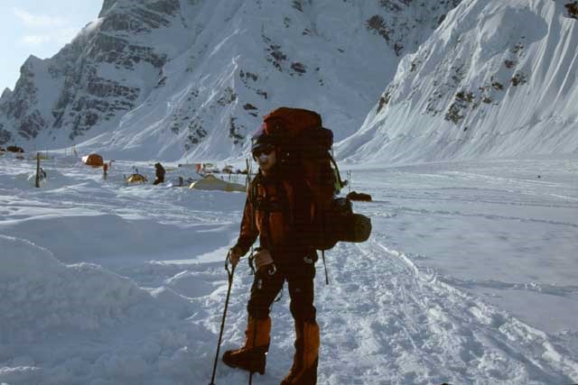
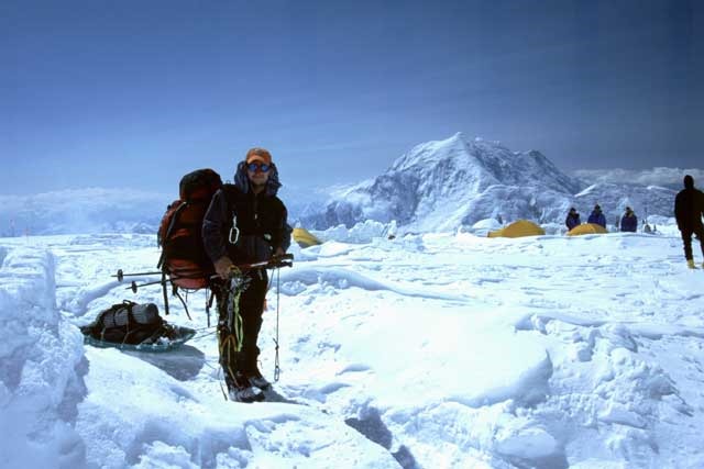
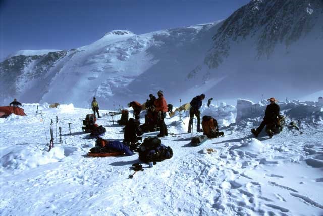
Our move up to the main camp of 14,200ft was today, and yesterday’s cache carry was helping with the acclimatization process. Camp was completely dismantled which seemed to take hours as normal.
Packs seemed to be about the same weight as yesterday although we were able to leave behind spare food for another Mt Trip group leaving the mountain after a very difficult summit success.
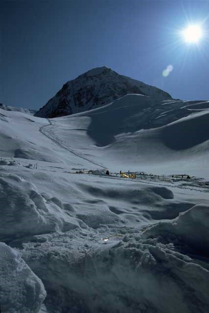
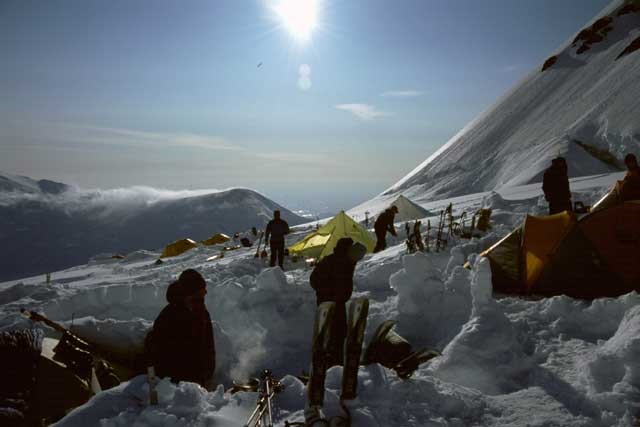
The day started the same as yesterday and warmed up at the top of Motorcycle Hill. I traveled second behind Chris in the front rope team and we made good process up to our previous days cache at 13,500ft. Like Chris said, the final part of the day up to 14,200ft takes it out of you – he was right! We had wind blowing snow into every bare nook and cranny, although thankfully this was sporadic and when we arrived at camp this all but stopped.
This camp has the NPS ranger’s site and is a main campsite leading up towards the fixed rope of the headwall. It is a large area of compressed snow which means no crevasses are located on the main site.
It was a very clear day and added to this the views all around and the multitude of colors of the different expeditions / privateers camps. The views were extremely picturesque.
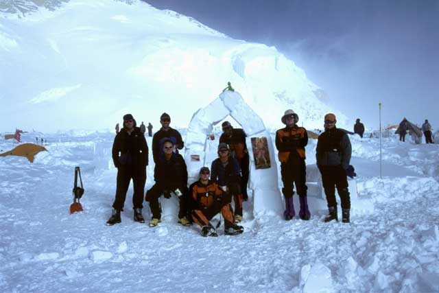
As Jose crashed out Jeff and I built a 10ft high archway from the building blocks saved from the kitchen tent, and on this we displayed the condomed gibbon, July’s Playboy centerfold and Jeff’s car photo – people were stopping by to have their picture taken next to the arch and we had some good comments from the guys throughout camp.
As we were higher up now the evenings after the sun disappeared became very cold, well below freezing – we soon crashed into our luxury -40 sleeping bags. It had been a tough day and thankfully a lay-in was possible tomorrow as we only had to retrieve the cache from13,500ft.
Sunday 15th June – Day 10
None of arose before 10.30 although the start schedule was far earlier! It was nice to have a lay-in and not leave camp until about 1pm, and we followed on with an easy hike back to 13,500ft near to Windy Corner, which wasn’t windy again! We dug the cache up and were back in camp within an hour due to good weather and our better acclimatization.
The rest of the day was in preparation for our carry up to our 16,900ft cache, just below high camp – this was to be a fairly hefty altitude gain, and after looking at the NPS weather board the temperature difference was about 10°F high at 14,200ft and -15°F at 17,200ft!! We lay out a rope with pickets and practiced what we will be doing once reaching the fixed lines which are located at about 15,500ft, passing over steep icy sections of the headwall.
It appeared that this camp was changing as a lot of people were heading up to high camp and a lot were passing through on their way down from summiting – we’ve seen good weather on the summit now for the past few days, just hope it holds for us as we have been very lucky so far!
Monday 16th June – Day 11
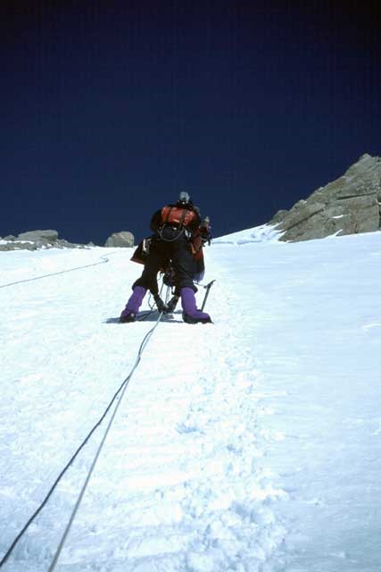
An early start was made for our hike up the headwall and fixed lines to our cache no.3. The loads were not heavy but jumaring up fixed lines was something most of us hadn’t done before. We planned on being at the bottom of the fixed lines by the time the sun appeared so as big mittens wouldn’t have to be worn.
We departed camp at 8.15 and quickly caught up with the AMS team, slowing our progress. The fixed lines looked very steep with big icy sections although when we reached them they weren’t quite so intimidating. There was a rope for ascending and another for descending that are pitched by the NPS at the beginning of the climbing season – we clipped our jumars into the right rope and pulled ourselves up, and as a precaution each team rope was also clipped into the pickets that the fixed lines were tied onto – each time we reached a new picket or join in the rope we moved the jumar to the upper side of the rope and clipped our climbing rope into the new fixed line. I was at the back of the first climbing rope so all I did was unclip our rope from the picket. It easier than I thought it would be and through our rope congestion we reached the top within 4 ½ hours. From there we continued right along a ridge towards Washburn’s Thumb, named after Brad Washburn, and a buried previous Mt Trip cache location at 16,400ft, where we recovered fuel.
Washburn’s Thumb was still a fair hike away and to get there we clipped into pickets installed by Chris on the more exposed sections. There was another fixed line leading up past Washburn’s Thumb which we didn’t use and just past that we reached our proposed cache site at 16,900ft, just forty minutes from high camp.
It was good that we cached this high as it means our back carry day would be easy. The trip back down was reverse and I had the joy of leading down the fixed lines face first with just the ascender – it was fun although I kept going too fast for Greg! After the fixed lines it was just a steep descent back to camp, although it can be very frustrating roped up as you just want to go downhill flat out! Today was long and tiring but we achieved good height gain and acclimatization.
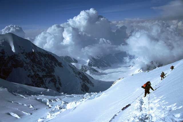
The views from the ridge were awesome as it was a very clear day with some of the best sights of all the Alaska Range, including the 14,200ft camp and some of the more difficult routes on the mountain.
Bed was a blessing tonight!
Tuesday 17th June – Day 12
Our first full rest day!!
We dragged ourselves up at about 11am when we heard an avalanche at our camp and all the oohs & aahs of people outside watching – I caught the last snowy part but it looked pretty impressive.
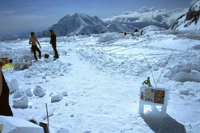
After our lunchtime snack Jeff and I built a throne and demolished the arch. The throne seated the entire team and was built from sawn snow, probably standing more than 4\’ tall. As it was such a sunny day neither of us had shirts on, hence I got pretty sunburnt! Uncomfortable! Jose’s idea was for a TV, so it was to be – we built a TV on 3 legs with lumps of jam for knobs, wands for the aerial and the July Playboy centerfold for the picture, although this never changed channel! Again, we had some people stop by for a look and various comments were made. During the season various expeditions pass by with spare food that they don’t want to carry back down with them – Jeff and I managed to get hold of four packets of pre-cooked bacon which we just spread out on the throne to heat up – tasty!
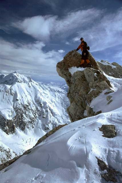
Later in the afternoon the team roped up and headed on the 15 minute walk to what is known as “The edge of the world” – an awesome drop-off of about 6000ft, where we could see our 7,800ft camp, the Kahiltna Glacier, and the valley of death – a heavily crevassed route which leads up to the base of the West Rib and the Cassin – both Alaskan grades 4 & 5, where our West Buttress route is a grade 2. Most people join the West Rib at 14,200ft and summit it from there – far easier than the entire route – this is sometimes known as the West Riblet!
The rest of the evening was spent in some discomfort due to the sunburn! Tomorrow was to be one of our toughest days with the move up to high camp in what looked like some cloudy weather.
Wednesday 18th June – Day 13
We were due up at 5am but Jose jolted us after 6am and we had heard no movement outside in the camp – it was decided that I would get up to find out if we were going for it or not and what the weather was like. It did look very white but not stormy so I went to Chris’s tent and he said that we are to leave and that they had lay in!
After ripping down camp we finally departed sometime after 9am for the haul up to camp 4 (high camp). The packs were a lot heavier than the previous days cache carry and the going seemed slower – we were the only people heading up this morning. Somebody came over and commented that the weather looks poor today!
We had no stops up to the fixed lines and made good time. Jeff managed to drop the handle to one of the shovels he was carrying and Zach went back down unroped to fetch it from where it eventually came to rest in the snow. The fixed lines on the 60° ice seemed harder this morning but we still made it to the top in three hours from camp 3. We stopped as before at 16,400ft and I felt groggy – the weather was white, cold and the wind was blowing snow everywhere and we had to wait for about thirty minutes for the other rope team to arrive. The next step was to be our cache site at 16,900ft so as we could collect the shovels and snow saw which were needed to erect camp that night.
The going was tough but not too cold thankfully. I was at the back of the rope team and I think that this caused me more strain as by the time the climbers in front got to a flat bit of terrain and I was still moving up a hill they were able to move quicker and this made me try to keep up making it a very breathless activity!
The views today were non-existent, totally unlike the previous cache climb – this is what we have come to envision of climbing in Alaska, the weather can change almost in an instant from clear to cloudy, from cold to hot!
We passed Washburn’s Thumb for the last time and arrived at our cache where we dug up the shovels and snow saw and continued for the final 45 minutes up to high camp and 17,200ft in altitude – the remainder of the route was impassable in high winds as most of it is extremely exposed with massive drop-offs either side, but today it was calm, although overcast. We were roped up into 2 teams and pickets were used on the more exposed sections.
A couple of years ago an RMI guide unclipped from his rope team to assist a client on this ridge and he was blown to his death due to a gust of wind.
Arrival at high camp was a pleasure although the short hill to get there was a disappointment! We found some disused sites at the higher of the two locations and promptly began making them usable – my tent-mates were a long way behind so I started clearing our site myself. Shoveling snow and ice at this altitude is hard work and my heart was thumping with a bit of dizziness. Chris and I eventually made it livable just when the second rope team arrived – Jeff collapsed on our tent site floor exhausted!
We got straight to work erecting the tent and made the site more protected – Denali can have massive storms up here and the guides spoke about being trapped up here for up to 9 days at a time in temperatures down to -50°F with winds gusting up to 100mph! The same can be said for the 14,200ft camp where we also had no such weather! As a precaution we secured the tent and rebuilt parts of the snow-wall around it.
After hot drinks and supper we retired for an early night after the hardest day’s work we have had on the mountain so far. This evening looked and felt warmer and clearer than at lower altitudes, although during the night the temperature dropped considerably lower. Tomorrow was to be a back carry to our cache located only 300ft vertically from us.
Thursday 19th June – Day 14
I think as usual we were scheduled to start at about 8am as the guides were going to do a carry via the Autobahn up to our high camp at approximately 17,600-18,200ft – this never happened and we had a rewarded lay-in.
As a team of eight we roped into 2 teams and headed back down to recover our cache at 16,900ft. The ridge was clear today and the weather was great – we could see down both sides with awesome drop-offs of 1000’s of feet. We arrived at the cache in about 20 minutes, recovered it, and headed back for what we hoped was the final time along the ridge – it was difficult passing other teams as the ridge is so narrow hence the normal principle of the ascending team having the right of way applied.
In the afternoon we all crashed out and chatted, read, and generally had a good laugh in the tent. The sunburn has ceased now so it is more comfortable in the sleeping bag, except for when the sun disappears and the temperature plummets to at least 0°F.
After tea and drinks we heard the other climbers arriving at camp, including our Swedish friends, in preparation for their own summit attempts within the next day or two, weather permitting. We planned on an early night as the next day was to be a single move up to and over Denali Pass at 18,200ft, and then down the other side to about 17,700ft.
Friday 20th June – Day 15
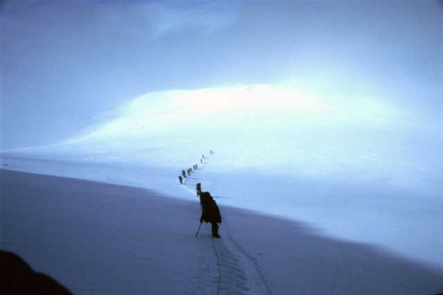
We wake on time this morning and start packing everything for our single push up to Denali Pass – this would put us in good stead for firstly the South summit, maybe the North summit, and finally completing the traverse back down the Muldrow Glacier.
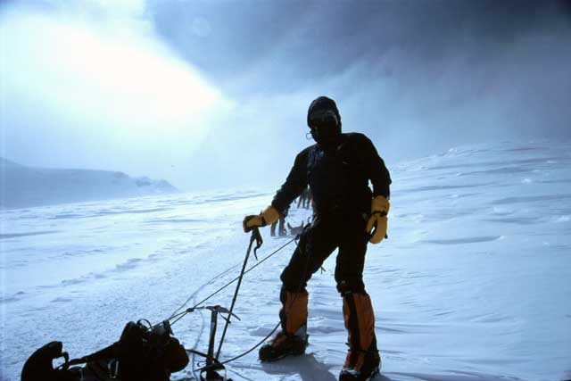
I decided to pull a sled instead of strapping it to the pack – at first it didn’t seem too heavy but soon we were pushing up the Autobahn towards Denali Pass. The combination of the backpack and pulling a sled was extremely strenuous at this altitude, although the height gain was only about 1000ft! It took us about four hours to reach the top and then we had 500ft of descent to our final high camp site at 17,700ft.
I found that if good crampon footings and placement aren’t made on this steep icy terrain the potential to slide down the Autobahn is great. I had a scare as I was kicking a step and suddenly the snow gave way and I fell only about four feet but with a sled attached and a very heavy pack it makes the heart rate increase a fair amount! You certainly make sure that your steps go into the ice and not just the snow!
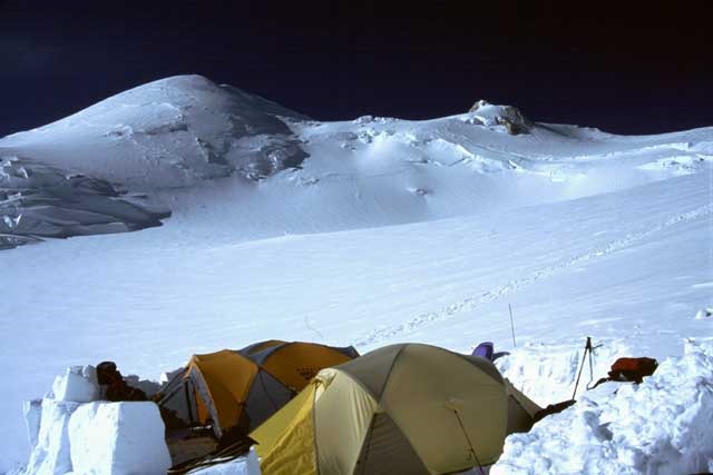
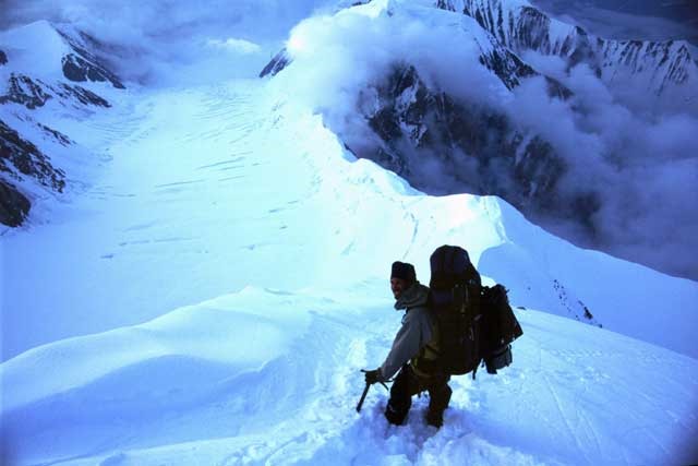
This (hopefully) final nights camp before the summit push was at 17,700ft and to our left was the North summit and to the right was the highest point in North America, the South summit, and straight down in front of us was the Harper Glacier, and our exit to civilization! Before that we would reach Karstens ridge, the Muldrow Glacier, McGonagall Pass, 20 miles of tundra, and finally the McKinley River.
We packed what was necessary for the summit bid, although the weather seemed to be cloudy but we were hopeful – the only hold up we had had thus far was on the flight out to the glacier which was pretty rare in Alaska. Here’s hoping for tomorrow!
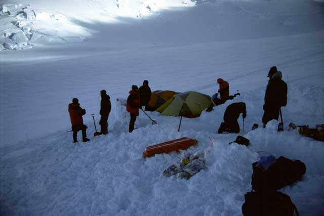
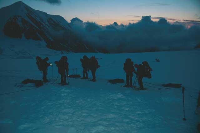
This was the first night that we had to establish camp from bare untouched snow as previously we had moved into part storm damaged property. Our site was checked for crevasses and we then started to flatten an area big enough for pitching the 3 tents and a cook area – this was fairly time consuming as the ice below the snow surface was extremely hard. Once the area was flattened out the tents were erected, then using a snow saw blocks were cut to build a wall around all the tents to protect them from the frequent storms and 100 mph winds that occur at this altitude.
Sleep was a necessity tonight in preparation for the hard day tomorrow.
Saturday 21st June – Day 16
Summit day has finally arrived although the top of Denali looked very cloudy – the word was given that we would give it a try anyway so up at 7am with warm drinks and food. We packed down jackets, face mask and ski goggles, and wore everything else we had, including Goretex parka & pants, and base & mid layers. Chemical hand and foot warmers were also taken for this part of the journey.
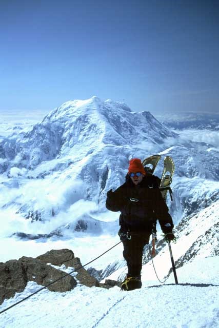
We departed at 9.45am and followed our previous day’s tracks back up to Denali Pass ready to take the normal West Buttress route to the summit. At this point the wind had picked up and it was approximately 0°F – we strapped on our face masks (in my case a neoprene mask with a vent for nose and small holes for mouth) that cover the nose, mouth and cheek areas to prevent frostbite from the cold and windy conditions, and proceeded up the route. We came across our Swedish friends at this point who we had spent a lot of time with on the hike up through the different camps.
Just before reaching Archdeacons Tower we stopped and at that point I thought we may be turning back as the weather looked pretty bleak – near whiteout conditions from time to time but not the cold luckily. Thankfully we plodded on anyway and had about 1300ft more to the summit – the next place we arrived at was obviously the Football Field, a large area of nothing but windswept snow and ice that had to be traversed before reaching the last hike up towards the summit ridge. This is only about 800ft from the summit but we could only occasionally make it out. The grind up the remaining height of Denali was tough and zigzagged some way up to the Denali summit ridge. At this point some of the team left their packs on the Football Field so it felt easier to travel (but not me!).
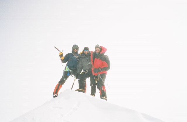
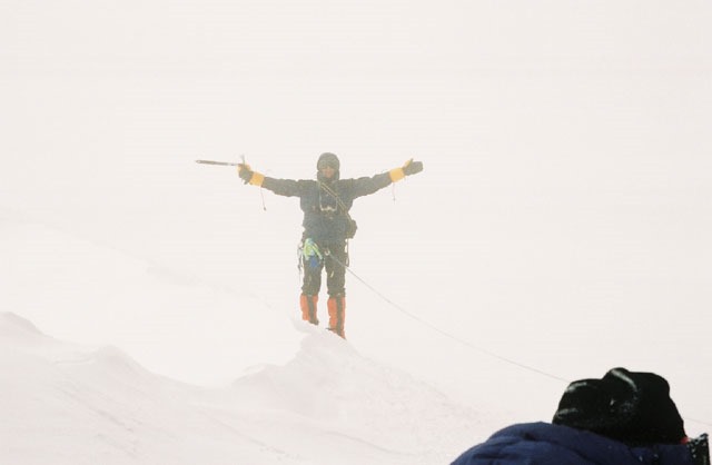
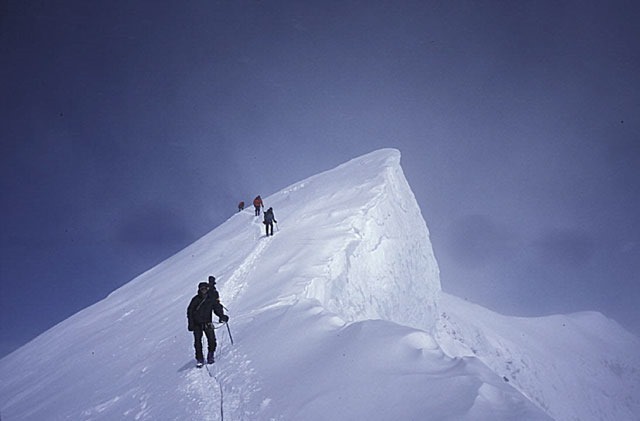
It didn’t seem to take too long before we were standing on the point known as the Denali summit ridge, from which it takes approximately 30 minutes to hike the last 300ft to the top of North America. We were fixing pickets along the more exposed parts and the Swedish lads were following closely behind us using our placements. Along parts of the ridge there were drop-offs of close to 9000ft to the right and 3000ft to the left, and we had to kick steps into the side of the ridge – this was precarious to say the least! Luckily it was cloudy and you couldn’t see right down the drop-offs, although it was still spectacular photography. There was one last ridge to ascend and then the summit came into view – this is the part where you seem to have endless energy and the remaining hike to the top is breathtaking.
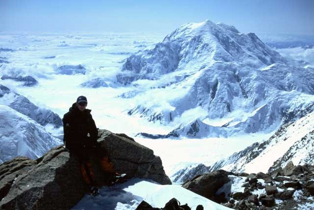
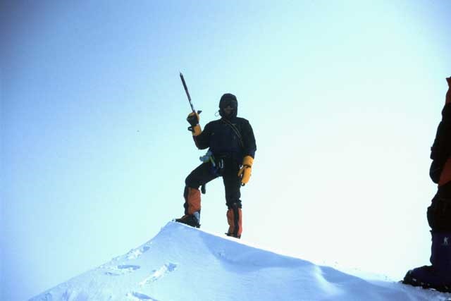
I was at the back of the second rope team so was the last to stand on top and be congratulated by the guides and the rest of the team, including Jose and Jeff who thanked me for arranging the trip! It couldn’t have gone better today, except having blue skies on top but that is a fairly rare opportunity and up there we were just extremely thankful that the weather allowed us the chance to get there at all, especially with the lower than 50% success rate that Denali has!
This was another dream, and a few worries all achieved in this ascent, however tough it was at times. Loads of photographs were exchanged including one with the 3 guides all topless! Now all we had to do was to get back down again in one piece, including the one part of the ridge that I found extremely exposed, although we did have a snow picket in place, just in case!
I led the second rope team down and got the frustrated feeling again as I was trying to move quicker than the climbers behind me and felt like I was being continuously held back – impatient! Back at the Football Field the wind was blowing the snow in amazing scenes across the awesome terrain – it looked like another planet, but you could also feel it tearing into any exposed skin you had on your face.
We eventually arrived back at the top of Denali Pass where the first rope team had already uncovered a cache left by a previous Mountain Trip expedition – we divided this up between the team members and started down the final 30 minute walk back to our high camp.
What a truly fantastic day, with it taking 6 hours to ascend to the top of North America, far easier than the summit of Aconcagua the year before! I now had earache, wind burns, and other aches and pains, but none that seemed to bother too much – all I wanted was to eat, drink and sleep!
Sunday 22nd / Monday 23rd June – Days 17 & 18
It was said that today we would go for the North summit but with the hike out down the Harper Glacier starting mid afternoon this seemed a bit like too much hard work. The decision in the end was to mill around camp until about 1pm when we would start down – it was relaxing and a good way of recuperating.
We emptied our 17,700ft campsite and started our descent with the heaviest pack I have ever had to carry – everything we had double carried up the mountain now had to be carried down in a single push – fucking heavy!
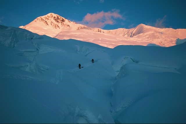
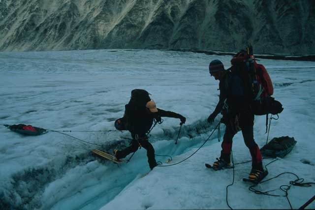
Firstly the crevasse ridden Harper Glacier had to be navigated and we had about eight falls within a couple of hours which made the experience hairy to say the least – fortunately they were only legs breaking through or waist deep falls through the snow bridges and as taut ropes were kept between us there wasn’t too much danger of major falls. Zach led the rope teams and had to probe for crevasses most of the route down – if you looked into some of the crevasses he marked they seemed bottomless and it was quite a challenge to leap over some of them, although, this danger didn’t detract from the beauty of the area in any way!
We now moved above the Harper Glacier but went to the right to gain our route down towards Browne Tower at 14,600ft, where this was fairly exposed with a drop-off down to our left leading directly onto the Harper Glacier, and further to our left was Pioneer Ridge – the route leading to the North Summit at 19,470ft. Here we met a couple of Norwegians who said that the upcoming Karstens ridge was exposed in a few places – how true! Other than that the entire route was ours and it sure was spectacular. We stopped for a couple of hours just below Browne Tower to eat from about 8-10pm so already it was becoming a long day.
From here we moved onto The Coxcomb, then Karstens Ridge, which didn’t seem too bad to begin with but we were to be very wrong – it was long and extremely exposed in places. The first part of Karstens was walking down a steep ridge with excellent ice axe arrest skills necessary, where to our left were the broken up Harper and Muldrow Glaciers, full of crevasses that could have fit small houses into!
It was hard work for me having to lead the second rope team, which included me at the lead, then Greg, Jeff and Zach at the rear, mainly so he could collect the snow pickets being placed by Chris for security. The adventure and adrenaline was about to begin and this was a whole new experience to me, and most of the rest of the team! The ridge looked pretty tame but was full of immense drop-offs either side of us. I was impressed with the guys having to pull the lightweight plastic sleds, particularly Jose who was right behind Chris breaking the trail. Any slip on some of the slopes we were on could have proved disastrous, and then there were the crevasses that had to be crossed with the huge packs and sleds. It certainly made your heart rate go up a few beats when striding and leaping over the bottomless crevasses.
Before the end of Karstens ridge we followed a trail down the side for 500ft or more which led onto the Muldrow Glacier, again heavily crevassed but as the time was now very early morning the snow bridges covering them would have been far more stable, and hopefully more capable of carrying our body weights plus packs. We were planning on camping close to another expedition who were hiking in via the Muldrow (NOLS – National Outdoor Leadership School) who were a couple of miles further down glacier. This part of the hike had no problems and we arrived in camp at about 8am after an extremely long day. As usual the area was probed for crevasses and all I remember at this point was leaning to one side with my pack on so that I could lie down whilst waiting, and then all of a sudden I was asleep in the snow!
Although it was breakfast it felt like we were meant to have an evening meal so tortillas with cheese was quickly devoured before crashing into a very unevenly pitched tent – after the previous 18 hours I could have slept on anything!
The next days travel was down the Muldrow Glacier, with Pioneer Ridge to the left and Carpe Ridge to the right, both following us down the glacier, which included the Great Icefall and the Lower Icefall, hence it was to be traveled at night when the snow bridges are firmer – we were due to get up at 10pm for a midnight departure.
Monday 23rd / Tuesday 24th June – Days 18 & 19
As expected we awoke at 10pm ready for a new adventure down the glacier – departure was after midnight when camp had been demolished. It started out over fairly flat snow as we zigzagged down the glaciated terrain to avoid the enormous crevasses.
Soon enough we came to the Great Icefall at about 9,500ft, where it was immediately obvious why it was so named – ice blocks everywhere with wide open crevasses and overhanging seracs, although there was a route leading through all this chaos which was either made by the very few climbers that had made it through this route or was in a condition from the previous year (the snowfall on the North side had been very limited this winter). This part was fun as the three of us who had hired snowshoes from Mountain Trip were cascading down the slopes within the icefall on a regular basis. I was at the back of the first rope team and the guys in front with their modern plastic snowshoes managed to move downwards easily which left me maneuvering slowly, hence when the rope went taut I was pulled over – it was a bit annoying but did make you laugh when it happened as there was nothing you could do about it until you came to a stop. The fun part was trying to get back onto your feet with an 80-100lb pack on!
The weather was, as usual, very good to us, although cloudy. The Great Icefall begins to get less “Great” and flattens out again into heavily crevassed terrain which we maneuvered through in the normal way, keeping a taut rope and zigzagging down the glacier. Soon came the Lower Icefall at 7,000ft and as it was now later in the day the snow and ice had become softer and we had many minor crevasse falls – this was especially true for Jose and Jeff who had removed their prehistoric Mountain Trip snowshoes. It shows that descending in only plastic boots is far more dangerous and difficult than using a large snowshoe!
The crevasse falls that we encountered usually looked quite funny as you would be traveling roped up and all of a sudden a team member would disappear up to their waist in a hole, or a leg would disappear. Chris, the guide and Andy roped behind him had this experience – I looked up in front of me and at identical times I saw then both buried up to their waists in snow – this looked a real picture.
The Lower Muldrow at this stage had a lot of slushy pools where the temperature was increasing and the glacier was melting. We began to cross more and more areas of rock, which was still all part of the glacier, and crossing 1-2 foot wide open crevasses. In the distance we could now see Gunsight Pass, and further on – McGonagall Pass at 6,560ft which was our route to the tundra.
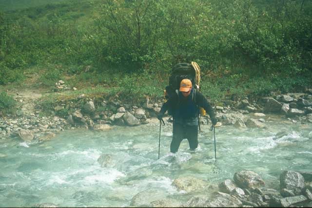
We decided to unrope some distance from the pass as the terrain was getting far less dangerous, the crevasses were narrower and mostly filled in where they had collapsed – the problems now were water running through snow-ice, and pools of water which were below the surface of the snow. This created fun as to jump across the waterways with a big heavy pack was not easy and more often the opposite bank would collapse upon landing – luckily plastic boots are deep and allow a certain amount of water depth before flooding! I had the experience of trying to cross snow which seemed fairly solid when all of a sudden it would give way and you would be knee-deep in water, making both feet soaking wet. This was not too much of a problem as we were soon at McGonagall Pass, where we had to cross some fast flowing glacial water and scramble up the hill to our freedom from the glacier.
This was the first (and only) hill, albeit small we had to climb with the mammoth size packs on. Once at the top we were thinking of camping as we were all knackered at this stage but opted instead for a grassy area which was about 4 miles away and reached by following the tundra and a glacial stream down the valley on our outward route. This would hopefully give a more comfortable nights rest and less of a hike the following day.
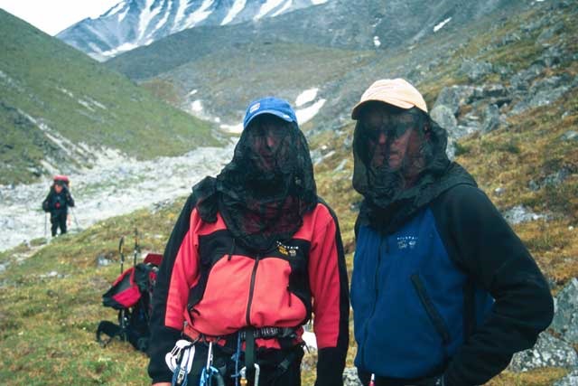
There was still snow about and I tried attaching my pack to a sled and pushing it down but to no avail – it just sank in the snow! About 8pm, after twenty hours of hiking we reached the first grassy area big enough to camp on and everyone decided that that was enough. A new problem was beginning now that we were on the tundra – mosquitoes, the size of flies and extremely annoying. It was vital to wear a head net and keep the tent doors tightly closed! I still got my ankles bitten up and a patch on my butt!
Bagels and bacon were eagerly devoured and the start of a well deserved nights rest began.
Wednesday 25th June – Day 20
Today was my turn for the sled and the tent flysheet which made the load even heavier than yesterday! It was, everyone agreed, the heaviest pack. I could get it onto my knee but struggled to swing it onto my back, and once up there I didn’t want to take it off again.
The hike today would hopefully take us to the mighty McKinley River, although we were to stop an hour short of it at Turtle Hill. From this point we saw no more snow, only tundra and the renowned river we had to cross. The day started off dry and bright but within a short time we were all soaked to the skin, with no Goretex as they were buried in our packs! After a few hours hiking we got to the first creek crossing, Cache Creek – as we were already drenched Jeff and I just waded straight through it. This was the shallowest of all the crossings, and when we arrived at Clearwater Creek we additionally had a fairly rapid current, but this again was waded straight through with no problems. As these creeks are glacial the water was extremely cold!
During the hike out everyone went at there own pace and we very rarely noticed anyone else in the whole team – the 3 of us kept going and had very few rest stops, mainly due to the packs being so heavy and we couldn’t be bothered to maneuver them onto our backs again and again!
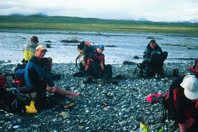
Eventually the rain stopped and we arrived at Turtle Hill at about 8pm. Only Zach was already there and we just crashed out to wait for everyone else – as food was now scarce we ate whatever was available so I sat there munching on dry bran flakes and sultanas! Slowly the rest of the team started filtering in but it was decided we would camp here for the night as it was now past 10pm and most people were very tired after another 12 hour day.
Thursday 26th June – Day 21
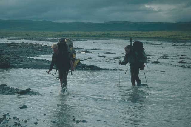
We were now in a hurry as the NPS shuttle bus to take us to Denali Park entrance was booked for 11am and we were still an hour short of the McKinley River. We set off downhill towards the river which didn’t look too much of a problem from where we were, and within an hour we were walking on the McKinley Bar. When the entire team arrived we started crossing the first of the many braids – the water was freezing!
We all made the first part but worse was to come as Jose went under first and got a drenching past his waist. The water was at maximum just under waist deep – enough to give the assets a shock! At parts the current was very strong and we all linked up in different formations to aid the crossing. As we neared the other side Nick, and then Jeff also had a tumble – although no one got too much upper body wet. The process of crossing the multitude of braids that make up the river was slow and it took us over an hour of being in freezing water to make it all the way over – it certainly didn’t take long for the feet to feel completely numb! Upon reaching the far bank shoes were removed, socks wrung out and put back on, and we were hastily on our way again.
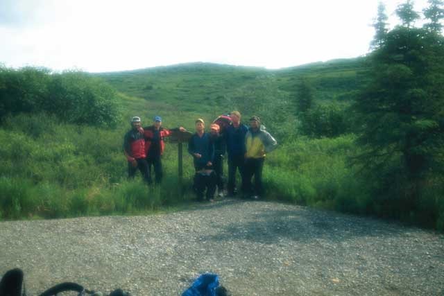
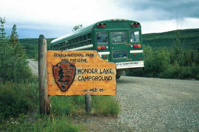
We had about an hour to get out now. The final hike I was soon on my own meandering up the trail through the forest and on occasions I expected to meet head on with a Grizzly, although thankfully his never happened. The exit out of the trail at Wonder Lake came too soon as the forest was so peaceful and full of birds and wildlife – I was now back in the land of tourists!
As it happened the bus that takes campers didn’t leave until 12.30pm so we had time to relax and rest, although the mosquitoes prevented this and head nets with DEET were applied in force! At 12.30pm we loaded our excessively heavy packs onto the back of the bus and we were on our way, albeit very hungry! We weren’t due to arrive at the park entrance until nearly 7pm, some 6 ½ hours later, and there was nowhere in the park where you could buy food or drink! We had a strategy, and thought that if we spoke loudly enough on the bus about how hungry we were then surely someone would be charitable – somehow it worked. We got chatting with loads of fascinated backpackers and one group of guys had loads of spare food so we were soon eating crackers, chocolate, crisps, salami, ham, etc… it was delicious!
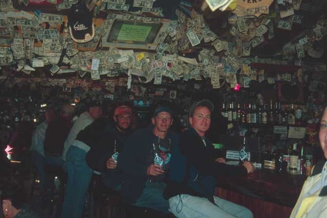
The park entrance came, followed by a well deserved shower and shave – I’ve never seen myself with such a beard! Loads of beer was bought for the shuttle bus journey back to Talkeetna – one problem – we weren’t allowed to have open alcohol on the minibus but between us we overcame this. We were drinking out of anything but the beer cans and the guys in front were holding up newspapers whenever they got the urge to drink! After stopping for various pizzas and more beer we eventually arrived back in Talkeetna at about midnight, hitting the Fairview Inn as soon as we turned up. It was a Thursday evening; the West Rib was already closed and the Fairview was quiet – we were all shattered and managed only a few beers before disappearing back to Latitude 62 for a nights rest.
Friday 27th June – Day 22
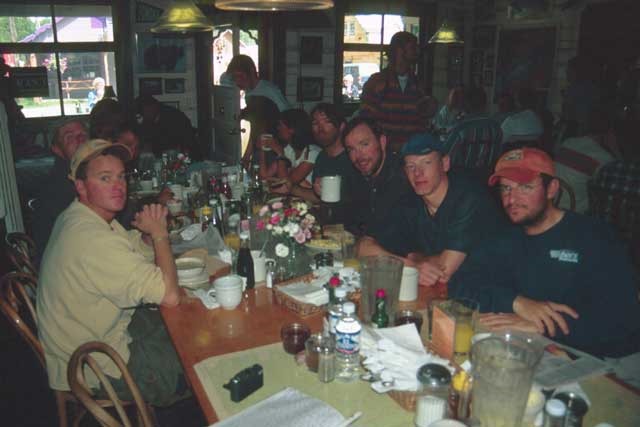
After a decent breakfast at the Roadhouse we checked in with the NPS ranger station to confirm that we were all safely back off the mountain and then departed for Anchorage.
In the evening we all took the guides out for a slap up meal to Simon & Seaforts seafood restaurant, followed by our favorite haunt, Humpy’s – what a beautiful meal and a great ending to a thoroughly enjoyable “kick ass” expedition. We all got complimented from each of the guides saying how much they enjoyed the trip which was greatly appreciated, and we hope they spend their tip well!
Four of us then hired a car for three days and drove the 5 hours to Homer to catch some serious Halibut……
Full marks to Mountain Trip and the guides for a well organized, professional expedition – www.mountaintrip.com
Also see Denali Traverse writeup by Greg Miller
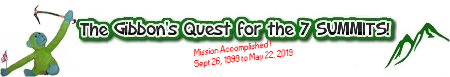
Next up for GGE (Green Gibbon Expeditions) is Castensz Pyramid or maybe Vinson…
Statistics
Climb Profile

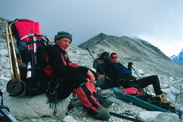
The Team
Chris Kerrick – Lead Guide
Zach Shlosar – No.2 Guide
Andre Callari- Assistant Guide
Wayne Morris UK
Jose Rionda US
Jeff Strite US
Nick Soderberg UK
Greg Miller US
Andy UK – bailed at 7,800ft
Miles UK – bailed at 7,800ft
Brendan UK – bailed before leaving for Talkeetna
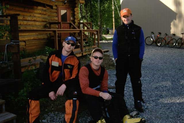
Photo Gallery